This morning we said good bye to Bill and Pam. They left early to make a power run (550 miles) back to their home in California after spending the last six weeks traveling with us. We’ re going to miss having them around to do stuff with! We backed up and headed for Provo. We took US89 north to I-70, I-70 east to US50, US50 north to I-15 and then I-15 north into Provo. This took us through three beautiful valleys, which made the drive a pleasant excursion. We are staying at the Lakeside RV Park ($56 per night with GSM) near Lake Utah. We have plans to catch up on some maintenance (Us and the Behemoth) and to see Timpanogos Cave NM. We will be here through the 4th of July, so we are planning a BBQ to celebrate.
Friday, June 30, 2023
26 June 2023 Dixie Loop
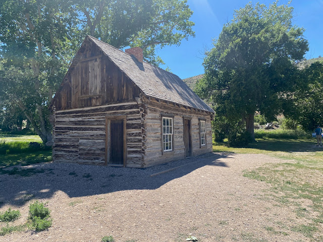
We were considering hiking Big Horn Canyon in Grand Staircase Escalante NM but the latest on-line review said the sand in the dry wash was like hiking in a sand dune for three miles. We did not want to subject Leslie’s ankle to that so we decided to do a driving tour to the north of Hatch. We loaded up all five of us in the Behemoth and headed toward Bryce Canyon. At the traffic circle, we took Johns Valley Road north along the edge of Dixie NF. We turned off at Old Escalante Road and stopped to explore the Wiidtsoe Ghost Town. There was only a couple of derelict buildings left of the town which was abandoned in the 1930s. rather than go back to the main road, we continued up the Old Escalante dirt road up into Dixie National Forest. The road was is really good shape so we continued up to the top of the ridge and then turned onto forest road L-140 deep into the NF along the ridge top. We came to a big meadow and saw 4 big Elk grazing. After another few miles, we pulled off to a trailhead and stopped to eat lunch. There were still 4 foot tall snow drifts in the shadows. It was fun exploring some new territory. We turned around and returned the way we came and continued north on Johns Canyon road until it intersected US89. We then headed south back toward Hatch. We came to a little park that had the boyhood home of the infamous Butch Cassidy. He lived here from the age of 14 to 18. The house was very rustic and small. Surprisingly, the cook stove was located in the center of the single room. We have never seen one positioned like that before. There was an old barn in addition to old farming equipment to explore. He definitely had meager beginnings. Then we headed back for home.
 |
| Wiidtsoe Ghost Town |
 |
| View from Forest Service Road L-140 |
 |
| View from Forest Service Road L-140 |
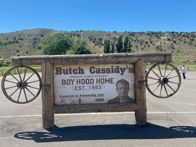 |
| Entrance Sign |
 |
| The homestead |
 |
| Main House |
 |
| Front of main house |
 |
| View in the main house through the side window |
 |
| The barn |
 |
| Old farm equipment |
Sunday, June 25, 2023
24 June 2023 Balloon Festival
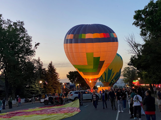
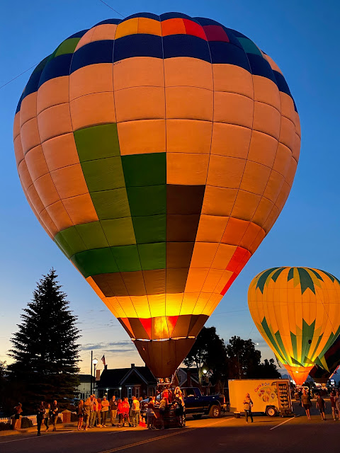
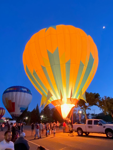
Having been back and forth to Panguitch over the last two weeks, we had noticed they were having a balloon festival this weekend. Talking with locals, we learned that it was a major deal for the town with bands and balloon rides and a balloon glow in the evenings. We headed into town in the early afternoon and walked through the vendor stalls and picked up some local treats to take home. We also got the details on the evening’s events before heading back to Hatch for a few hours. Later we went back into town and went to Kenny Ray’s Café for a simple but good dinner. After dinner we got out our chairs and set them up along Main Street in the shade to await the start of the music and the balloon teams. Around 8pm the bands began playing and the balloon crews pulled into to begin inflating their balloons for the glow. We had never seen a balloon get inflated before so it was interesting to see that they initially inflate the balloons partially with fans before using the burners to blow in hot air. As the balloons went up we walked Main and Central streets to see the balloons and to get some pictures of the glow as it got dark. By 9:30 they were deflating the balloons and the show was over. Maybe we will have to go to the Albuquerque Balloon Festival one year.
23 June 2023 Navajo Loop
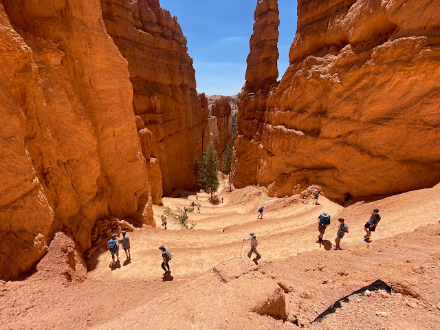
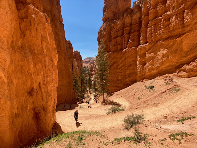
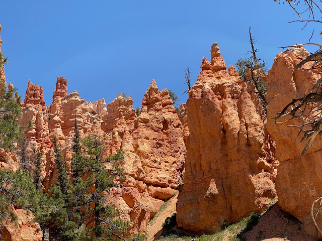
After having looked down into the canyon from overlooks, we really wanted to hike down in to see the hoodoos from a different perspective. A front was moving in today and it was predicted to be cooler and windy, perfect hiking conditions. We drove back to Sunset Point in the park. Pam and Lacy settled down by the car while Leslie, Bill and David put on our packs and headed to the Navajo Loop Trailhead. This is another very popular hike and there were a lot of people on the trail. The Navajo Loop Trail (1.76 miles, 495 feet of elevation gain, 688 calories burned) goes down the Two Bridges Trail and back up the Wall Street trail creating a loop. There are a lot of switchbacks going down before you hit a short relatively flat trail and then 29 switchbacks going back up. The views along the trail are magnificent and we took lots of pictures! We went around the loop clockwise since we had been told that was the easiest way back up. It only took 1.5 hours for the hike with us stopping to take so many pictures. It is definitely a different perspective looking up at the hoodoos verses looking down from the canyon rim. The climb back up wasn’t too bad considering the altitude since the switchbacks helped keep the climbing angles reasonable. The trail was is in reasonable shape but it was clear that they had a lot of repairs to make from last winter’s damage.
 |
| Hoodoos at eye level going down Two Bridges Trail |
 |
| Switchbacks going down Two Bridges Trail |
 |
| Switchbacks going down Two Bridges Trail |
 |
| Switchbacks going down Two Bridges Trail |
 |
| Two Bridges |
 |
| Start of the climb back out on Wall Street Trail |
 |
| Hoodoos towering above us |
 |
| The hoodoos look a lot bigger from here |
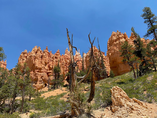 |
| Feeling small |
 |
| Wall Street |
 |
| Start of the switchbacks going back up on Wall Street Trail |
 |
| switchbacks going back up on Wall Street Trail |
 |
| switchbacks going back up on Wall Street Trail |
 |
| Almost to the top |
22 June 2023 Mossy Cave
Directly off UT12, in Bryce Canyon National Park is a short trail that runs along a creek. It goes back into a canyon where there is a cave with water running down its walls supporting a sea of moss. There is also a cute artificial water fall. The waterfall is fed by a ditch that was dug by the Mormon Settlers between 1889 and 1892 to divert water ten miles from the East Fork of the Sevier River to Water Canyon. The hike is only a mile out and back. This is a very popular hike and there were people everywhere. We parked in the overflow parking and hiked our way up to the trail split. We went up to Mossy cave first and then to the waterfall. There were lots of people playing in the river both above and below the falls. You could walk in behind the waterfall if you were willing to get wet from the spray. We elected to stay dry. After the hike, we drove down into Tropic and poked around the souvenir shops before heading for the Stone Hearth Restaurant up the canyon. We arrived 45 minutes early for our reservation, but they were able to seat us at an outside table with a beautiful view of the orange cliffs across the canyon. We enjoyed a delicious dinner in a beautiful setting. We then drove to Sunset Point in Bryce Canyon NP and watched the colors change on the hoodoos as the sun set before heading back to Hatch watching for deer on the road.
 |
| Waterfall on Mossy Cave Trail |
 |
| Mossy Cave |
 |
| Hoodoos from Mossy Cave Trail |
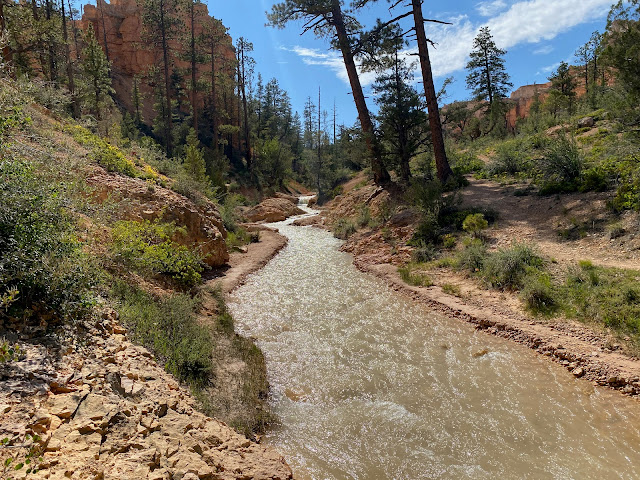 |
| The creek that feeds the waterfall |
 |
| Hoodoos on Mossy Cave Trail |
 |
| Sunset at Bryce Canyon |
 |
| Sunset at Bryce Canyon |


