Monday, July 26, 2021

25 July 2021 Castle Mountains NM and Mojave Desert Preserve

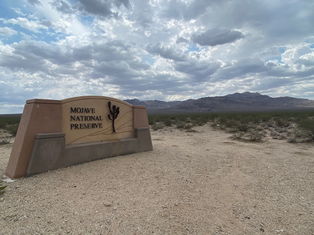
 Castle Mountains NM is one of three “gap filler” national monuments created by the Obama administration when they could not get legislation through congress to set these lands aside. Right in the middle of Castle Mountains NM is the huge open pit Hart Silver and Gold mine. There are no trails, no park facilities and no visitor center. Nor are there plans for any to be built. We took US93 south out of Las Vegas to Seachlight. There we topped off on fuel before taking Nipton road to Walking Box Ranch Road. Walking Box Ranch Road is the main road into the NM that was built for the Hart Mine. But it is a well-maintained, compacted dirt and gravel road that we were able to travel along at 45mph for most of the distance. The road ended at the entrance to the Hart mine at mile marked 17. Other than the sign at the entrance to the NM, there was not much to see beyond desert, lots of Joshua Trees, mine trash and the brown rock Castle and New York Mountains. There are the remains of other small mines in the NM and a series of four-wheel roads going to them from the Hart Mine road. All of them are closed now except the Hart mine (which is not actually running at the moment). We decided to take a different route back and followed some of the unmaintained four-wheel drive roads out of the NM and into the Mojave Desert Preserve. The lands in the Castle Mountain NM were specifically excluded from the Mojave Desert Preserve when it was created by congress in 1994 to protect the mining interests. We followed these roads past some abandoned mines and ranches before reaching the main road in the preserve, Ivanpah Road. We took Ivanpah north until I-15. Near the junction with I-15, there is a massive solar power facility that uses mirrors to focus the sun light onto the top of a tower. You could see the reflection off the tower from a long ways away and it looked like alien space ships landing from a distance. Jumping on I-15 north, we were a bit surprised by the amount of traffic heading toward Las Vegas. It backed up at the state line where people were slowing down to get a picture of the welcome to Nevada sign. We hit some rain near the border but it dissipated quickly. So we crossed another NM off our list and enjoyed the adventure. 


Entrance Sign

Castle Mountains


Back entrance to Mojave Desert Preserve


Solar Plant

Entrance Sign


18 July 2021 Extraterrestrial Highway

 Having heard about the Extraterrestrial Highway, we decided to go explore the area. We took US93 north out of Las Vegas, passing where we had come out from the Desert Wildlife Refuge yesterday. Just short of Hiko, we turned off on Nevada 375 toward Rachel. Just after the turn we found the Alien Research Center up on a hill with a tall metal alien creature by the front door. It is of course a major tourist trap, be our curiosity got the best of us, so we stopped and went in. Its basically a tourist shop but had some fun and unusual items. We then drove up 375 to Rachel. The tiny town of Rachel is extraterrestrial central. We stopped in the little cafĂ© there, enjoyed the various alien signs and pictures, and had overpriced hot dogs for lunch. But in general, the extraterrestrial experience was underwhelming, but fun because of being unusual. There is a whole lot of nothing in this part of Nevada. Just desert and brown rock mountain ranges. 


17 July 2021 Tule Springs Fossil Beds NM and Desert national Wildlife Refuge


The NM is north and west of Las Vegas. So we looked up a Diner Drive-ins and Dives (DDD) recommended restaurant to try in that area. We stopped at the Four Kegs sports pub for lunch. It was delicious, but in the process of eating lunch, David’s implanted tooth broke off at the bone and came out! That is not supposed to happen since the posts for those implants are made of titanium. One more thing to worry about getting fixed. Our research on Tule Springs Fossil Bed National Monument showed that the monument was created in 2014 but that no improvements have been made. No marked trails, no parking lots and no visitor center. The only thing we could find was a sign that had been recently been placed along the one road that goes through the northern portion of the park. Nothing indicated when anymore would be done to improve the park for visitors. So we drove up to the sign, took a picture and called it done. The same road ran into the Desert National Wildlife Refuge. This is the largest National Wildlife Refuge in the lower 48 states. Over half the refuge is also part of the Nellis Air Force Base Training Range and is off limits to the public. From the visitor center (which was still closed due to COVID), there are two primitive roads that travel through the open portion of the refuge. We decided to take the Mormon Wells road for a ways to see some wildlife. We ended up doing the whole 47 miles over to US93. The road was listed as four wheel drive and high clearance required but we never put the Behemoth in for wheel drive nor did we need its high clearance. But the road was very rough so we could only go 10-15MPH. The road climbs up to Mormon Pass where we saw the only other humans on the road (in the campground). The only wildlife we saw was a ground mole and a tiny rabbit. The scenery was bleak and brown but there are lots of Joshua Trees. When we climbed up into the pass there were plenty of cedar and pine trees. Not a drive we would choose to repeat. When we exited on US93 we notice there were no signs to indicate the road was there or where it went to. If we had not started on the west side by the visitor center, we would never had know where to turn.  On the way back to Las Vegas we ran into some welcomed rain to wash the dust off the Behemoth. 

Tule Springs Fossil Bed NM Sign

Entrance Sign


Mormon Well Road


Sunday, July 4, 2021

3 July 2021 Valley of Fire State Park

 We had seen a lot about Valley of Fire State Park while researching things to do around Las Vegas. So it was at the top of our list. We headed out in the late morning for the park. It is 58 miles from where we are parked. The temperatures in Las Vegas were headed for 109 degrees, so we were hoping the park would be cooler. The exit off I-15 is onto an Indian Reservation for 20 miles to the western border with the park. It is very desolate country. The entrance fee was $15 (because we were out of state visitors). After looking over the map, we turned off the main park road at the scenic loop, a gravel road that takes you through some red rock formations before joining the paved road by the campgrounds. We stopped at Arch Rock to grab some photos of the red arch when another visitor started pointing up on the rocks behind the arch. Tucked back in the shadows of a cave, you could see 7-8 Big Horn Sheep sleeping the hot day away in the shade. Temperatures were over 110 degrees in the park. So much for finding cooler temperatures. Next stop was the Atlatl Rock, where there were some 2000 year old pictographs including one that shows a hunter using an Atlatl. We then stopped at the visitor center for some postcards before heading up the scenic drive into the heart of the red rock formations. We stopped at the Silica Dome, a rock formation made out of pure silica, where the Star Trek scene where Capt. Kirk is killed was filmed. The rock formations certainly seem unworldly! The colors in the rock were spectacular. Unfortunately the Wave trail was closed due to the heat. But we still enjoyed the drive. On the way out of the east gate, we stopped to see the cabins that were built by the CCC in 1936 for the first visitors to this park. Exiting the park to the east, we entered Lake Mead National Recreation Area. Just past the fee station we took a gravel road to an overlook for the now deserted town of St. Thomas. The remains of the town was covered when Lake Mead filled up in the 1940s. But the lake is now at record low levels and the church from the town is visible on a vast dry plain. The Lake has not been full since 1983 due to water usage and record drought. We continued south along North Shore road (there was no shoreline visible for most of the drive) until eventually we could see water and we turned down one of the access roads toward the lake. The lake is so low it was not really accessible unless you were ready to do some rock climbing. So we continued down to Henderson where we stopped at Famous Dave’s BBQ for some take out food. We haven’t seen a Famous Dave’s since our last visit to Junction City. Finally getting back to the Wanderer after 8pm to realize we had missed the Las Vegas RV Resort 4th of July party. We had enjoyed our day so much we had forgotten about the party. 

Entrance Sign

Big Horn Sheep in the shade

Petroglyphs at Altalt Rock

Colors in the rock

Winding Scenic Drive

CCC Cabins

Entrance sign for Lake Mead

Lake Mead


Friday, July 2, 2021

27 June 2021 Red Rock Canyon National Conservation Area

 After a week of being stuck in the Wanderer because of her ankle and the heat, Leslie needed to get out! So we headed out for a Mexican Food Sunday after a stop at SAMs Club. Then we decided to visit another one of our planned destinations and headed out to Red Rock Canyon National Conservation Area (run by BLM) just west of Las Vegas. With her ankle still swollen, we were not planning to hike. We stopped at the visitor center to pick up some post cards. We were surprised to find the movie was available! Our first park movie since February 2020! This was one of the nicest BLM visitor centers we have seen so far. We drove the 13 mile scenic drive and stopped at the various pull outs to take in the views. We will need to come back for some hiking when it is cooler. 


20 June 2021 Mount Charleston

 After falling and twisting her ankle, then being stuck in the Wanderer for 4 days with a swollen, aching ankle, Leslie was getting shack wacky! We decided to escape the heat of the city for a few hours. After getting a Mexican Food Sunday fix, we drove up to Mount Charleston in Spring Mountains National Recreation Area just north of Las Vegas. It was also Fathers Day, so there were a lot of families having picnics on the mountain. We drove the loop through the small town of Mt. Charleston and also up to Lees Canyon (a ski resort). The temperatures were in the mid 80s. The area is very pretty with lots of beautiful trees (with cactus mixed in). After enjoying the views into the valleys below, we reluctantly head back down. The temperature back at the Wanderer was 116F!