Friday, May 28, 2021

26 May 2021 Goblins Everywhere!

 David worked through the morning. But in the afternoon, we headed out to Goblin State Park ($20 entrance fee). The main feature of the park is Goblin Valley. There is no marked trail through the valley, you just wander through the Goblin shaped rocks (1.6 miles, 85ft of elevation gain, 1089 calories burned). 170 million years ago the valley was a tidal flat and layers of sand and clay built up over time and compressed. Some layers are harder than others. The wind, rain and freezing has sculpted the rocks into fanciful shapes. We spent a couple of hours wander amongst the Goblins amazed at the variety of shapes and sizes. We also scoped out where we needed to go for the slot canyons we want to hike later in the week. 


Entrance Sign

Goblins everywhere?

ET is back!

Leslie in the Goblins


24 May 2021 Thompson Spring to Hanksville

  It is a short drive (90 miles) from Thompson Springs to Hanksville. The scenery along the drive is different from what we have been seeing in the Moab area. Hanksville is along the Fremont River. Its larger the Thompson Springs and has more services (including a grocery store). We are staying at Dukes Slickrock Grill and RV Park ($218 for a week, no discount). It’s not a pretty RV Park, but it will do for a week. We have several hikes planned in the area and may also drive down to Lake Powell. We went to Dukes Slickrock Grill for dinner. It was some of the tenderest BBQ we have had in a long time. The BBQ sauce was very good, not too sweet, not to spicy. 

23 May 2021 Thompson Canyon

 Before Cynthia and Felix headed for the airport, we went back to the Pictographs/Petroglyphs in Thompson Canyon. After we returned to the Wanderer, we regretfully said Goodbye to Cynthia and Felix as they headed back to Grand Junction and their flights home. We then began on our chores to get ready to leave ourselves. David cleaned the layers of dust out of the Behemoth after weeks of driving dust roads and put up the outside items. Leslie cleaned the Wanderer (endless dust blowing in) and caught up the laundry. 

22 May 2021 Corona Arch Return

 We woke tired after three days of on the go so we delayed our start to Moab. We picked up Cynthia and Felix and went to the trailhead for Corona Arch. We stopped at the petroglyphs along Potash Road for Cynthia and Felix to see. As usual, the parking lot was full and we parked in the overflow across the street. It was cloudy and cool, perfect hiking weather. When we reached the other side of the railroad tracks, we stopped to get out breath and take in the view. A lady fell hard on the trail near us and was bleeding from multiple cuts. Several folks stopped to help. David pulled out his first aid kit and he and Felix helped badge up the cuts and get her to her feet. She was a little shaky, but seemed ok with her husband. So we continued on up the trail. Cynthia was a little intimidated by the cable climb but made it up just fine. We took our time absorbing the beauty of the Bowtie and Corona Arches. Cynthia and Felix once again declared this was the biggest winner of all the arches!! The clouds seemed to be getting darker and more ominous, so we started back to the trailhead. Big cold drops of rain began to splatter around us as we worked our way across the slickrock to the cable. We got to the top of the cable and worked our way down as quickly as we could. Thunder rolled nearby quickening our steps. The rain drops seemed to be chasing us out of the canyon. As we reached the head of the canyon, lightening shot across the sky and there was a very loud crack of thunder that echoed in the canyon. The lightening and thunder began in earnest as we reached the end of the trail and headed across the street for the Behemoth. People were running all around us for their cars. Just as we got into the Behemoth the skies opened up and it began raining hard. Excellent timing! We headed back into town to get a late lunch and do some last minute shopping on main street. We went back to Josie Wyatts to enjoy a drink and fun conversation before heading back to the Wanderer. Rain threatened a bit, but the wind dies down and we were able to start a fire. The temperatures were just right for a fire and we sat around it enjoying the company and the warmth while taking turns going inside for showers. Then the wind suddenly returned and we had to dose the fire. 

Cynthia and Felix with Corona Arch in the background

Leslie and David with Corona Arch in the background

David holding up Corona Arch

Cynthia and Felix in front of Bowtie Arch

Cynthia, Leslie and David in front of Corona Arch

Ominous Clouds building behind Corona Arch

Face in the rock

Climbing down a steep part of the trail

Felix, Leslie and Cynthia stand at the top of the cable climb

looking back at Corona and Bowtie Arches as we leave ahead of the storm

People on the cable climb

Cactus Flower

Cynthia and Leslie in front of Corona Arch


21 May 2021 Driving Tour

 We awoke to rain pattering on the roof. A quick check of the weather radar showed rain around the entire area but slowly moving east. So we changed our plans a bit and delayed our start. The rain moved on and we picked up Cynthia and Felix in Moab. We started the drive along the Colorado River and stopped at the Castle Creek Winery. A waitress had told us they were closing, so we wanted to stop in and do a tasting before they were gone. We found a couple of wines that were pretty good, so we picked up 4 bottles to enjoy later. We then picked up the La Sal Mountain Loop and enjoyed the wonderful views as we took it all the way around to the south of Moab. We took US191 south to the turn off for the Needles District of Canyonlands NP. We stopped off at Newspaper Rock before proceeding into Canyonlands NP. We followed the main road all the way to the end, stopping off at the overlooks and driving through the campground before heading back to Moab. Back in Moab, we enjoyed a wonderful steak dinner at Josie Wyatts.

View from La Sal Mountain Loop 

Leslie, Cynthia, Felix and David in front of Newspaper Rock

Cynthia, Leslie, and Felix at Wooden Shoe Arch Overlook

Leslie and Cynthia at the end of the road

Us at the end of the Road


20 May 2021 Return to Dead Horse

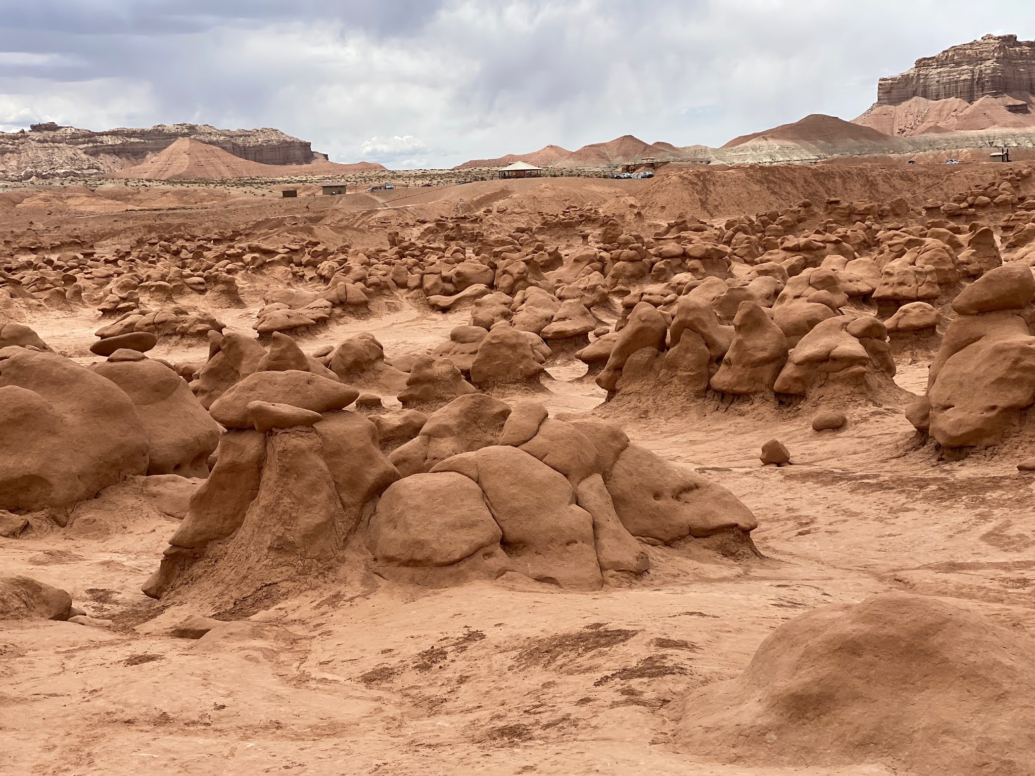
 Our plans for today include a drive to Dead Horse Point State Park and then on to Canyonlands National Park to hike the Mesa Arch and Grand View Point Rim Trail.  Again, David and I had done this a few days earlier but knew that Cynthia and Felix would enjoy seeing it all.  Dead Horse Point was a spectacle and we had a great time exploring to point, taking dozens of pictures and gawking down into the massive canyon.  We all agreed the legend of the point was a tragic story.  After a successful stop in the Visitor Center, we loaded back into the behemoth and took off down the road to Canyonlands. We enjoyed stopping at the Visitor Center overlook. As we hiked down to the overlook point, a gust of wind nearly blew Cynthia and I over the edge! It was so strong and obvious it was here to stay for the rest of the day. Finding the trailhead for Mesa Arch, we hiked the short trail down.  It was fun to see Cynthia and Felix’s reactions to the sight of this beautiful marvel.  It looks so old and crumbly but reveals a majestic view through the arch of a jaw dropping painted canyon of pinks, blues and purples.  You can’t really see that until you walk right up to it.  We waited in the buddy line to get our picture taken.  It was about a 30 minute wait. I swear one family was making a movie up there! We enjoyed talking to a conservative from Ohio who was very vocal about his disdain for liberal conservatives and liberals overall.  He wasn’t shy about his opinions. They were so entertaining! He saw 2 lizards run under the foot of a woman walking back to the trail.  As she took another step she almost stepped on one and screamed.  He very loudly yelled “She’s a lizard stomper.  She needs to be thrown out of the park!”  We were doubled over laughing.  We took their picture and they went on their way.  The couple behind us, of course, had been listening to our entire conversation.  When it came time for them to take our picture in front of the arch, we smiled and posed.  It looked like he took 2 or more good pics, but upon inspection later that day, we found he hadn’t taken a single shot. On purpose? Who knows… 

We then drove to Grand View Point and it certainly is! We ate our lunch in front of a spectacular view.  We got out and explored a little and then decided we had enough of hikes.  Felix and Cynthia wanted to see the dinosaur exhibits David and I had told them of because it fit their oil and gas careers.  We then drove out to Mills Canyon and enjoyed the dinosaur tracks exhibit and the dinosaur trail exhibit.  While hiking the short and fun dinosaur trail exhibit, we saw numerous fossils in the hillsides. Unless you were told you would have no idea what you were looking at.  On our way back to the behemoth, we looked up to see a single pronghorn doe very close to us walking back up the hill from the wash (which had a little water in it).  Great close to our day!  We went to pick up David at the Wanderer for dinner. 


We wrapped up the day with dinner on the patio at the Sunset Grill. Built into the side of a cliff, the views over Moab and the canyons were wonderful. Sunset Grill was the home of a miner that struck it rich after finding and exploiting a big Uranium deposit back in the 1950s.


View from Sunset Grill

View through Mission Arch

Overlook Point

Cynthia and Felix at Dinosaur Exhibit Trail (Mills Canyon Road)


19 May 2021 Return to Arches

We woke up early after our late night, had a hearty breakfast with burritos and fresh fruit, then flew out the door a little before 8am.  We made it to the park by 8:30am, just in time to get in before they closed the place because of capacity quotas.  David stayed at the Wanderer to work, so Cynthia, Felix and I (Leslie) got down to exploring the sites.  And what sites indeed! I took them to the arches David and I had explored when we came to the park a couple weeks earlier. I don’t care how many times you visit this park, it’s extraordinary every single time. The shear size of the different rock formations is breath taking.  We explored the North and South Windows Arches, Turret Arch, Double Arch, Sand Dune Arch, Landscape Arch, Skyline Arch, Delicate Arch and Balancing Rock.  All agreed that the Windows, Turret and Double arches were the big winners of the day. Afterward we decided a relaxing drive and some site seeing along the Colorado River would be a nice way to wrap up our adventure for the day.  It is a beautiful drive that offers shear red cliffs shooting straight up into a bright blue sky.  Gorgeous!  We drove into Moab afterward, stopping at the liquor store for supplies and heading to Cynthia and Felix’s hotel to check in.  We finally got all the gear carried up to the room and cracked a bottle of wine.  Felix took a shower but Cynthia and I just stayed grimy and were thoroughly sated by the day’s activities.  We called David to let him know our day was complete and he drove into town to meet us for an early dinner. We ended up at Zak’s Pizza.  Then headed to respective lodging for an early night to bed (and well deserved!)


Cynthia and Felix in front of Balanced Rock

Felix (Blue shirt on the rock) at Double Arch

Cynthia and Felix in the canyon to Sand Arch

Felix holding up Sand Dune Arch


18 May 2021 Visitors!

 Leslie’s sister, Cynthia, and her husband Felix arrived late to the Wanderer after flying into Grand Junction. They are spending 5 days visiting Moab with us. It is great to have visitors again! They are spending tonight with us before heading to a hotel in Moab tomorrow. Leslie has four full days of sight seeing planned for them. 

Monday, May 17, 2021

16 May 2021 Thompson and Sego Canyons

 With everything close to Moab overrun with people, we decided to explore a bit closer to home. David was talking to the neighbors that told him about there excursion into two canyons just north of the RV park. So he checked with the office and they provided him a map. We had hoped we could rent an ATV from the RV Park, but they stopped renting their ATVs a couple of years ago due to the cost of liability insurance. But they assured him we could do the roads in our Behemoth. So we headed out this morning for Thompson canyon and then Sego canyon (they intersect five miles into Thompson canyon. As we drove through the small town of Thompson Springs, we were surprised at just how run down the town was. The Ballard RV park was definitely the highlight of the town. Thompson Springs was the main railroad stop for the area from 1883 through the 1920s. The stage stop was saw yesterday on Cotter Mine  Road was the halfway point for the stagecoach from Moab to Thompson Springs. It served as a refueling point for the steam locomotives through the mid 1950s. Its interesting that this section of tracks has been carrying trains from the 1880s through today. Our first stop was several panels of Petroglyphs and Pictoglyphs about 3.5 miles from the railroad crossing. The area to the west of the road is BLM land and as such, not very well maintained. There is a mixture of Pictoglyphs and petroglyghs on panels on both sides of the road. Some of the art dates back before 2000BC, some of it is more recent (1200-1600AD). There is newer graffiti as well. BLM has installed a couple of motion activated cameras to attempt to catch people defacing the panels. On the opposite side of the road, there is another panel with almost life size pictograph figures, but it is on private land and given the numerous no trespassing signs, we could only admire from a distance. We continued up Thompson Canyon to Sego Road. We headed up Sego Canyon just a little ways until we reached a old graveyard. The graveyard was fenced all the way around to keep the public out. We walked around the perimeter and tried to read the few headstones. There were a lot of unmarked graves, which were apparently associated with the mine up the canyon. The most recent we could headstone discern was in 1996. It’s a very quiet location. We then drove further up the canyon to the ghost town of Sego. This town at one point was home to over 500 people. The town was the primary support for the coalmine. The coalmine and surrounding lands changed hands several times. Coal was first mined here in the late 1890s and grew in size in 1911. In 1914, the railroad built a spur up to the mine to help move the coal faster. The spur crosses the creek flowing down the canyon 13 times. It supplied coal to the trains coming through Thompson Springs until the mid 1950s when the trains converted to diesel electric. The only two builds left visible are the rock walls of the American Fuel Company Store and the American Boarding House. The town shut down in 1955 when the coal mine went bankrupt. The road up to Sego was in great shape so we decided to continue up the canyon. We eventually reached the top of the canyon at 8500 feet where there was a locked gate at the Ute Indian Reservation boundary. There were pines and birch trees everywhere and the air smelled so fresh and clean. We were surprised to find three trucks with large horse trailers parked up there. Reading the signs, we learned this was a jump off point for the Sego horse trail into the road less Book Cliffs wildlife district. Apparently there is excellent elk hunting in the Book Cliffs but it is rugged terrain and several horses and mules die each year on the tough trail. The views from the top of the canyon are incredible and we were not in any hurry to leave. We headed back down Sego canyon until we reached the junction with Thompson Canyon road. We turned up the canyon and followed the road until we reached the end, not far past the ruins of a 1960s communal town with a communal bread oven. One of the “homes” was built with railroad ties from the closed spur (We also saw several ranches had used the abandoned ties as fence posts).  There was a pipe sticking out of the ground with water flowing out of it into a little creek with a sign warning not to contaminate the drinking water. Before the little communal town we crossed a low spot with a little water on the road and a large flat area with wild grasses and bushes. We learned later that is the water source for the town. A series of French drains catch water here and pipe it down to the town. Sure glad we have a good water filter on the Wanderer! It was a fun day of exploring.

Rock Art in Thompson Canyon

Rock Art in Thompson Canyon

Rock Art in Thompson Canyon

Rock Art in Thompson Canyon

Rock Art in Thompson Canyon

Rock Art in Thompson Canyon

American Fuel Company Store

Remains of American Boarding House

Gate at Ute Indian Reservation border

View from atop Sego Canyon

View on Sego Canyon Road

Threading the narrows


15 May 2021 Park Row from the back door

 Man, are we getting tired of the 40 mile drive to Moab! There was one trail in Arches we still wanted to hike. Its called Park Row trail. It runs along the bottom of a canyon with massive red rock buttes and fins running down both sides. Being the weekend, we knew we needed to be there early, but we got a slow start and reached the entrance to Arches NP at 9am. Only to find it was closed already for maximum capacity! So we decided to try another trail we had seen along the Colorado River called Grandstaff. It had great reviews on Alltrails. But when we pulled up to the parking lot at the trailhead, it was full as was the overflow parking across the road. Damn! So we decided to explore some of the dirt roads off US191 north of Arches NP. We turned off on to Mill Canyon road and followed it. To the junction with Cotter Mine Road. There we read the information board and looking at the map, we decided to take Cotter Mine Road instead of Mill Canyon. A little ways up Cotter Mine Road we found the dinosaur tracks exhibit. First found in 2009, the exhibit is of a variety of dinosaur tracks dating back 116 million years. The area was a shallow lake and apparently a gathering area for at least 20 different types of dinosaurs. Some of the tracks are easy to discern in the rock, others were not very visible. A bit further down the road, we came to the ruins of Upper Courthouse Station, which is where the stagecoach from Moab to Thompson Springs would stop. Beautiful place for a stage stop! We continued down Cotter Mine Road until it dropped us back on US191. Heading north on US191, we turned off onto Willow Springs Trail since we had noticed a lot of people boon docking off this road. We were surprised at how many people were camping back in the area with everything from Big Class A Motor Homes to little pod trailers. The road was actually in pretty good shape, but we would not be pulling the Wanderer down it. We followed the road until we came to the Willow Springs Dinosaur Tracksite. We had to crawl over the exposed slickrock until we reached the parking area. But if you came to Moab with a 4x4, you have to do some slick rock crawling at some point! We parked and walked the exposed bedrock with various dinosaur tracks embedded in the bedrock. These dino tracks were supposedly 165 million years old. At this point, David realized we were only a couple of hundred yards from one of the back entrances to Arches NP! But those last couple hundred yards were rough with some pretty big drop offs. We just dropped the Behemoth into 4 low and crawled our way over it with ease. The first ½ mile in the park was equally rough road, but the Behemoth handled it with no issues. David was more worried about the tires, not being off road rates, than the ability of the Behemoth to crawl over the rock ledges. Then we were on a nice sand road. We picked a point with a really nice view and stopped to eat lunch while admiring the view out over the Salt Valley. We then continued until we reached the main paved road in Arches NP. We giggled about having snuck in the backdoor to the park! We decided we could still do the Park Row trail and drove down to the Courthouse Rock overlook and parked there.  Turns out, this was the perfect place to start this trail from since you would be going up hill on the way out and down hill on the way back and the parking was wide open. The sun was high overhead and between the sun beating on us from above, and the radiated heat from the rock walls and floor of the canyon, it was hot! Park Row Trail (2.2 miles, 422 feet of elevation gain) follows the dry bed of the canyon bottom with massive red stone buttes and fins on each side. The canyon walls were magnificent as we walked past the Three Gossips stone formation and up the canyon. Most of the canyon floor is exposed slick rock and the erosion marks in the rock were very pretty. At one point it cuts through a sandstone rock formation and the erosion left beautiful swirling grain in the rock. We walked until we reached the climb to the parking lot at the other end of the canyon before turning around and returning the way we came. This is a beautiful hike! Leslie became a little overheated, so we took our time going back, but there was no shade to be found to cool off in. Back at the Behemoth we turned the air conditioner on MAX and left it that way for most of the ride back to the Wanderer. As we drove past the main entrance fee station, the line to get into the park stretched for over a mile. We just thumbed our noses at the fee station and grinned ear-to-ear!

116 million years old Dinosaur Track

Mill Canyon Dinosaur Tracks Exhibit

Upper Courthouse Station

165 years old Dinosaur Track at Willow Springs

Back entrance to Arches NP

View of Balanced Rock just before we joined the paved road

The Three Gossips

Park Row trail

Red Rock pillar

Looking down into canyon


Reefs on the East side

Rocky Buttes

Looking toward Courthouse Rock (center)

A new arch in the making