 |
| Climbing up the Slickrock |
 |
| Corona Arch |
 |
| Bowtie Arch |
 |
| Corona Arch |
 |
| Looking up at Corona Arch |
 |
| Heart Shaped Formation |
 |
| Looking through the backside of the Arch |
|
| Climbing up the Slickrock |
|
| Corona Arch |
|
| Bowtie Arch |
|
| Corona Arch |
|
| Looking up at Corona Arch |
|
| Heart Shaped Formation |
|
| Looking through the backside of the Arch |
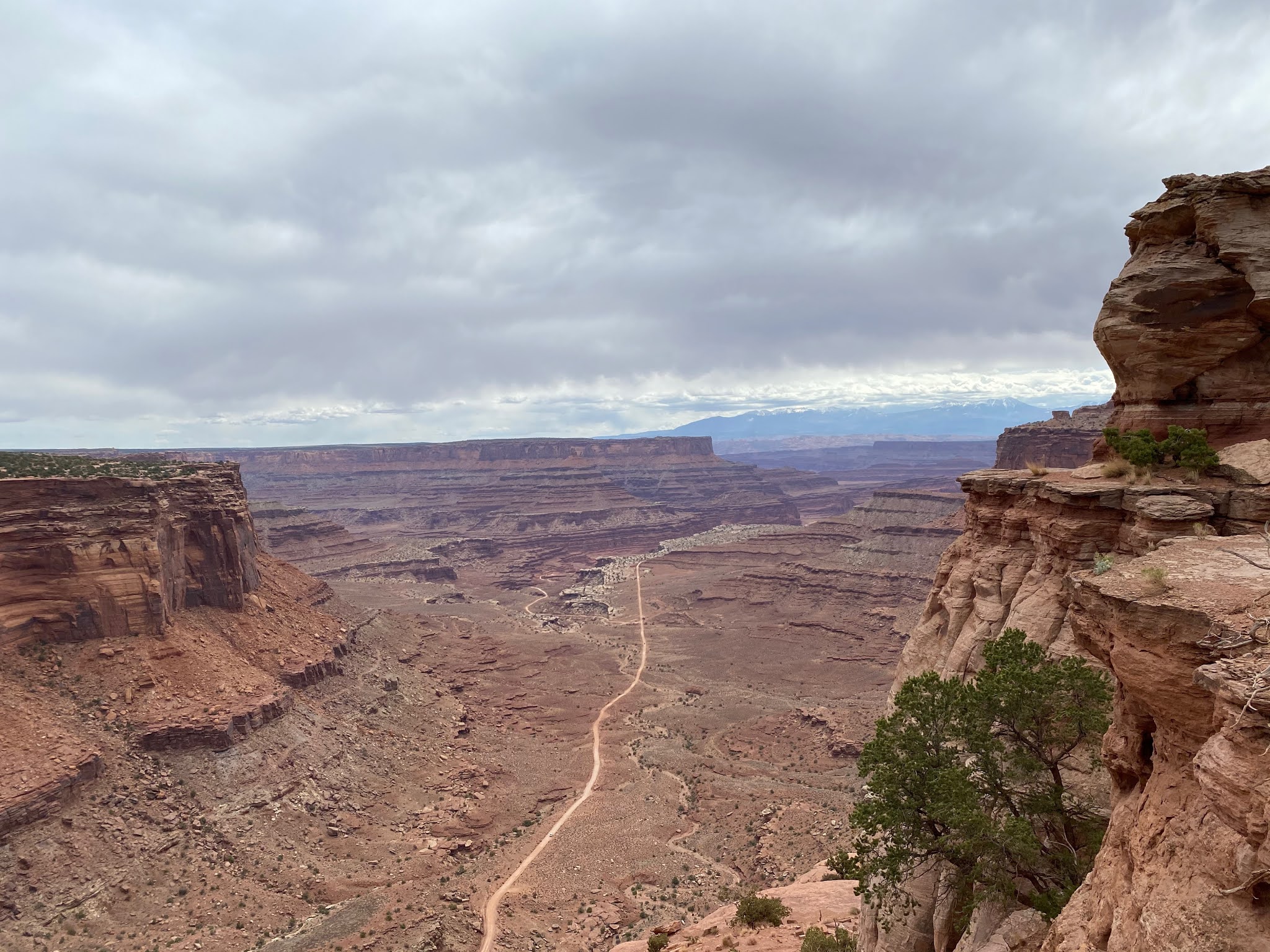
Having spent so much time in the Needles district of Canyonlands NP, we were looking forward to the Island in the Sky district. Island in the Sky is located on the Colorado plateau from which all the canyons eroded from. We approached the entrance and were surprised to find a line to get in. Being further away from Moab, we thought it would be less visited. But we ended up crawling along for 30 minutes to reach the entrance fee station. Once in the park, we stopped at the visitor center, then the Schaffer canyon overlook from which we could see the steep 4-wheel drive Schaffer Trail road we planned to take on a future visit. Then headed for our first hike, Mesa Arch (0.7 miles, 88 feet of elevation gained, 592 calories burned). This is a popular trail and it was very busy. Mesa arch is spectacular because of the incredible expanse of canyons you can frame through it. We really enjoyed the views through the arch, even with all the people in the way. We headed next for the Upheaval Dome area of the park. Along the way we went out to the Green River Overlook to see down into the canyons carved by the Green River over millennium. We had planned to eat lunch at Upheaval Dome, but there was no parking available, much less a picnic table. So we headed back toward the junction until we found a really nice overlook with a place we could pull the truck off the road to eat lunch. We were sharing the spot with another couple of Texas who had the same idea. We then worked our way down to the parking area for the Grand View Point Overlook. Again, the parking lot was packed but we managed to find a spot big enough for the Behemoth and grabbed our hiking gear. It was kind of funny that we kept running into people we had seen yesterday in Arches. We took the Grand View Point trail (1.8 miles, 173 feet of altitude gain) from the overlook to the points. The trail runs along the edge of the cliff (2500 feet down) out to the point. It was fun to watch people posing for pictures on the rock overhangs without realizing how far the drop off was below them. The views down into the canyons of the Needles district were amazing. We could see the White Rim road running along the cliff edges to the next layer of canyons. We plan to take this 100 mile road later in the week. We could not see the confluence of the Colorado and Green Rivers due to the haze.
 |
| Island in the Sky entrance sign |
 |
| View into Butler canyon |
 |
| Mesa Arch |
 |
| Looking through Mesa Arch towards Needles District |
 |
| Butler Canyon |
 |
| Red rock as far as you can se |
 |
| View from Grand View Point |
 |
| Grand View Point trail runs along the edge of this cliff |
After having been turned back last Monday, we made sure we were up early this morning. We reached the entrance to Arches at 8:45 and found a long double line of vehicles. It took us 45 minutes to reach the entrance fee station! Once through, we headed directly for our first hike since we knew the parking would be limited. We got lucky when we pulled up to the Windows Section of the park and got a parking spot for the Behemoth as someone else was leaving. There were a lot of people taking at least a portion of this hike. We did the full Window Loop Trail (1.3 Miles, 272 feet of elevation gain, 809 calories burned) from which we were able to view the North Window Arch, South Window Arch (front and back) and Turret Arch. Completing that, we hiked around the parking area to the Double Arch Trail (0.6 miles, 125 feet of altitude gain, 593 calories burned). Again, there were lots of people and kids, but the views of these magnificent rock arches overshadowed all the annoying noise and people. Finishing up there, we drove to the Garden of Eden overlook for a quiet place to enjoy lunch. Figuring that Delicate Arch was still extremely busy, we headed to the Devils Garden area of the park. Along the way, we stopped at the Fiery Furnace overlook and Salt Valley overlook. We had thought about doing the Fiery Furnace trail, but you have to have a permit and they are really hard to get hold of this time of year according to the ranger. Besides which some of the scrambles may be more than Leslie’s knee can take. We stopped at the Sand Dunes Arch and hiked the 0.2 mile trail to the arch. You are walking between these two towering fins of red rock on accumulated wind blown sand. The arch is off in a side alcove that you could walk past if you were not looking for it. When we arrived at the Devils garden, there was a surprising amount of parking available. Our plan was to hike to the Landscape Arch and maybe beyond to two other arches. The temperatures had climbed to over 90 degrees and we were feeling it. The Landscape Arch Trail (2.1 miles, 299 feet of altitude gain, 937 calories burned) is a very well traveled and graded trail. There were nor scrambles over rocks or huge steps to clamber over. Landscape Arch is beautiful and very iconic. Back in September 1991, a large section of rock (180 tons) fell from the arch (scaring the crap out of some hikers). The park service closed the area under the arch to visitors fearing more of the arch will tumble off. Beyond the Landscape Arch, David forged a head on the trail and saw it climbed a very steep slickrock for quite a distance and knew that we were not up for that climb. So we turned around, taking advantage of the few shady spots on the trail to cool off. Making it back to the Behemoth, we sat for a few minutes to regroup in the wonderful air conditioning. We headed next to Delicate Arch, figuring that being late in the day, there would not be so many people. We were correct, there was almost no one at the Delicate Arch overlook. It looks so out of sorts sitting on top of that huge stretch of slick rock all by itself. We have talked about doing the delicate arch trail, but want to do it on a cool morning since that huge slab of slickrock heats up all day and bakes hikers. Four Hikes, 9 Arches, 4.2 miles hiking, 750 feet of altitude gained, 92 degrees with a relative humidity of 8% was all we felt like doing in one day! So we headed for the visitor center, wanting to get there before it closed. But we did stop on the way at the Balanced Rock and hiked around it a bit looking for that perfect camera angle. We arrived at the visitor center 15 minutes before the store closed (the visitor center and exhibits are still closed due to COVID). Leslie picked up her post cards, David his park hat and another NP coffee cup, as well as our park stamp for our NP Passport book. It was a wonderful day!
 |
| Arches Entrance Sign |
 |
| North Window Arch |
 |
| North Window Arch from the side |
 |
| Selfie in front of Turret Arch |
 |
| South Window Arch |
 |
| North and South Window Arches from the back side |
 |
| Unmarked Arch near Double Arch |
 |
| Double Arch |
 |
| Looking up at Double Arch |
 |
| Hiking to Sand Dunes Arch |
 |
| Sand Dunes Arch |
 |
| Landscape Arch |
 |
| Skyline Arch |
 |
| Delicate Arch |
 |
| Balanced Rock |
We got a bit of a late start today. We drove down to Arches NP entrance. After stopping to fight a crowed to get a picture of the entrance sign, we drove into the park only to be turned around. The park has set capacity limits due to COVID and parking limits and the park was “Full” at 1:30pm. Disappointed, we quickly came up with a plan B and headed for Dead Horse Point State Park ($20 entrance fee). The park received its name from the way the cowboys would herd maverick horses out onto the rocky point and fence them in. With fence on one side and 2500 foot drops on the other three sides, the wild horses were trapped. The cowboys would pick the horse they wanted for stock and leave the rest to die on the rocky point with no water. Seems they were competition with the cattle for grazing. The park is fairly small but has nice picnic areas, campground and several mountain biking trails which seemed quite popular. We stopped at the store so Leslie could pick up some more post cards. There were some trails along the rim by the visitor center that had incredible views into the canyons and the Colorado River. In the distance was the evaporation ponds of a phosphate mine which disrupted the views. We then drove out to the point and walked the rim trail while shooting LOTs of photos. The views of the deep canyons cut by the Colorado River were awe inspiring. The spectacular variation of colors in the cliffs are just not the same in the photos as in person. It gave us a taste of what to look forward too in the northern portion of Canyonlands NP. After soaking in the views, we headed into Moab to grab a early dinner and go grocery shopping (it’s the nearest store to where we are staying). We were surprised to find many of the restaurants closed until 5pm. We tried a recommended steak restaurant only to find it was not opening for dinner for an hour. The owner came out to apologize and explained he could not find people to hire. But the owner recommended we go over to Pasta Jays since they were open and said the Jumbo Stuffed Shells were fantastic.
So we strolled over to Pasta Jays and got an outside table by the sidewalk along Main street. It was amusing to watch who was wearing face masks and who was not (Moab requires a face mask in town.). The food was pretty good an we relaxed and enjoyed ourselves. Then we headed to the grocery store. It was chaos! The place was packed with shoppers (everyone was wearing their masks) and we were constantly dodging around folks to find the things on our shopping list. We were really happy to get out of that chaotic environment and back to the peace of the Behemoth for our 34 mile drive back to the Wanderer.
 |
| Entrance Sign |


 |
| Colorado River |

We reluctantly left Monticello behind and headed to Thompson Spring, 30 miles north of Moab. We had tried to stay in one of the RV parks in Moab, but by the time we had started making reservations, after waiting to see what was going to happen with COVID, we could not find one that could handle our rig and have three weeks available. So we headed to Thompson Springs, just off Interstate 70, at Ballard RV Park ($500 (monthly rate) for 3 weeks (21.73 per night)). We are parked in the brand new section (added late last year). The landscaping is brand new and mostly gravel and rocks with some new trees. There is a truck stop nearby but that is it, no restaurants, no stores, etc. We will have to drive 31 miles to Moab for everything.
The Monument Valley Navajo Park, like all the parks on the Navajo reservation, is still closed. We kept hearing rumors it would open soon, but as we got closer to our time to leave, we decided to settle for one of the guided tours outside the park. Leslie found a 2.5 hour sunset tour ($156 for two) through the Gouldings Lodge, just outside the park. We left early for the two hour drive down to Monument Valley so we could get dinner at the lodge. As we headed down into Monument Valley, we came upon the point on US163 where Forest Gump stopped running. Due to the popularity of stopping for a photo from this spot, they dropped the speed limit down to 35MPH and installed pullouts. We of course stopped for a photo. The views of the buttes in Monument Valley were wonderful. We pulled into the lodge and stopped to go to the gift shop (Leslie needed more post cards) before walking over to the dinner. We ate an early dinner (we both had the Navajo Taco) before joining the other folks going on the tour. Our Navajo guide, Art, pulled up with the truck. Our seats were in the back in an open air deck. Fortunately the weather was perfect, for an open air tour. Art’s grandfather, who passed away last year, was one of the famous Marine Navajo Code Talkers during WW2 in the pacific. First stop was to a purpose built Navajo Hogan. A traditional Navajo home design. We went inside and Art explained the structure’s design and how a traditional Navajo Family would live in the structure. We then drove to an overlook off US163 on the north side of the valley. We then went back to the area of the lodge where he took us off road and up through Horse Canyon. We parked and hiked to where there is an arch with beautiful views of the valley through the arch with the setting sun lighting up the buttes with a warm orange glow.. We then hiked around to another overlook where we could also see some ruins tucked into a cave that were used by the Navajo lookouts. The views were beautiful! Then it was back to the lodge to end our tour followed by a two hour drive back to the Wanderer and Etta.
 |
| Forest Gump stopped running here |
 |
| Goulding Trading Post |
 |
| Shadow Picture |


 |
| Valley through the Horse Canyon Arch |
 |
| Ruins in Horse Canyon |


 |
| Hourse Canyon |

