Sunday, June 25, 2023

21 June 2023 Hole in the Rock Road

 We had heard of the Hole in the Rock Road for the last several years. The road was built by the Mormon Settlers to move goods from the Colorado River into this area of Utah. The Mormons chipped and blasted a path through the cliffs down to the river. The road was only used for a year before easier routes were available. The road is 58 miles long with 51 miles of it going through the heart of Grand Staircase Escalante National Monument. The stretch in the NM is somewhat maintained by Bureau of Land Management. The last 7 miles are in Lake Powel National Recreation Area and is high clearance four wheel drive. Bill, Pam and David (Leslie decided to saty home) headed out early to Escalante. We stopped at the visitor center in Escalante to pick up information and check on the road conditions only to find it closed. The poster with the “latest” road conditions which said it was being graded. The first few miles of Hole in the Rock Road were not too bad. There was some washboard, but the ridges were low enough and the spacing close enough that if you got up to 30 miles and hour it was not to bad a ride. But the washboard got much worse the farther you went, with the ridges getting tall and spaced far apart. We could not find a speed that we could go over them without shaking the truck, and us, violently. So we ended up slowing to 5-10MPH and crawling along. We stopped at the Devils Garden at mile 34 and walked around the incredibly shaped rock formations. Then continued on to Dance Hall Rock where we stopped to explore some more. Dance Hall Rock was a stop for the Mormon Settlers on the road where they would play their fiddles in the dome for the acoustics and dance on the flat area in front. Lacy had fun chasing jack rabbits here. At this point we were 38 miles in and it was 2:30 in the afternoon. Facing another 20 miles of slow going and then have to turn around and drive the 58 miles back out was going to take 7-8 hours. So we decided to head back out. We hit pavement around 4:45  and headed back to Escalante. We stopped for dinner in town before returning to Hatch to find Leslie spent the day deep cleaning the 5th wheel.

Rock formation in Devils Garden, Hole in the Rock Road

Rock formation in Devils Garden, Hole in the Rock Road

Rock formation in Devils Garden, Hole in the Rock Road

Rock formation in Devils Garden, Hole in the Rock Road

Rock formation in Devils Garden, Hole in the Rock Road

Rock formation in Devils Garden, Hole in the Rock Road

Rock formation in Devils Garden, Hole in the Rock Road

Rock formation in Devils Garden, Hole in the Rock Road

Dance Hall Rock, Hole in the Rock Road

Dance Hall Rock, Hole in the Rock Road

Chimney Rock, Hole in the Rock Road


Tuesday, June 20, 2023

19 June 2023 Red Hollow Slot Canyon

 We heard about this slot canyon near Orderville that the public could access without requiring a guide. After a bit of research, we found the Red Hollow Slot Canyon which is right by the city of Orderville’s water supply. So we drove on down from Hatch and followed the directions we had to the parking area by the water plant. Pam elected to stay at the car, while Bill, David and Leslie picked our way down into the dry wash and followed the dry wash to the mouth of the canyon. The dry wash was filled with deep powdery sand which was not fun to slog through but once in the canyon it was beautiful. The first several hundred yards of the canyon was flat and easy, filled with twists and turns. Then we came to some boulders which required some scrambling to get over. Leslie opted to stop here. Bill and David crawled over the boulders, dropped into a very narrow area which required sliding against one wall to squeeze through at and angle, then scrambling over an even bigger boulder. We found ourselves on a flat area and went around a corner to find a 20 foot high pour off with no way around it. So we turned around and headed back to the car. The Red Hollow Canyon trail (1.35 miles, 213 feet of elevation gain, 484 calories burned) only took an hour. SO we decided to head up to Duck Creek to try the hamburger place that Tom had recommended to us. After lunch it was back to the RV park. Late in the afternoon, Our Cousin Beth stopped by for a quick visit. Her and John were in the area for their 40th Anniversary. Unfortunately, John is experiencing some back problems and was not able to stop by to visit. But it was great to see Beth and catch up on family happenings. 


Entrance to the slot canyon

Side canyon


Final Obstacles

End of the trail


18 June 2023 Kodachrome Basin

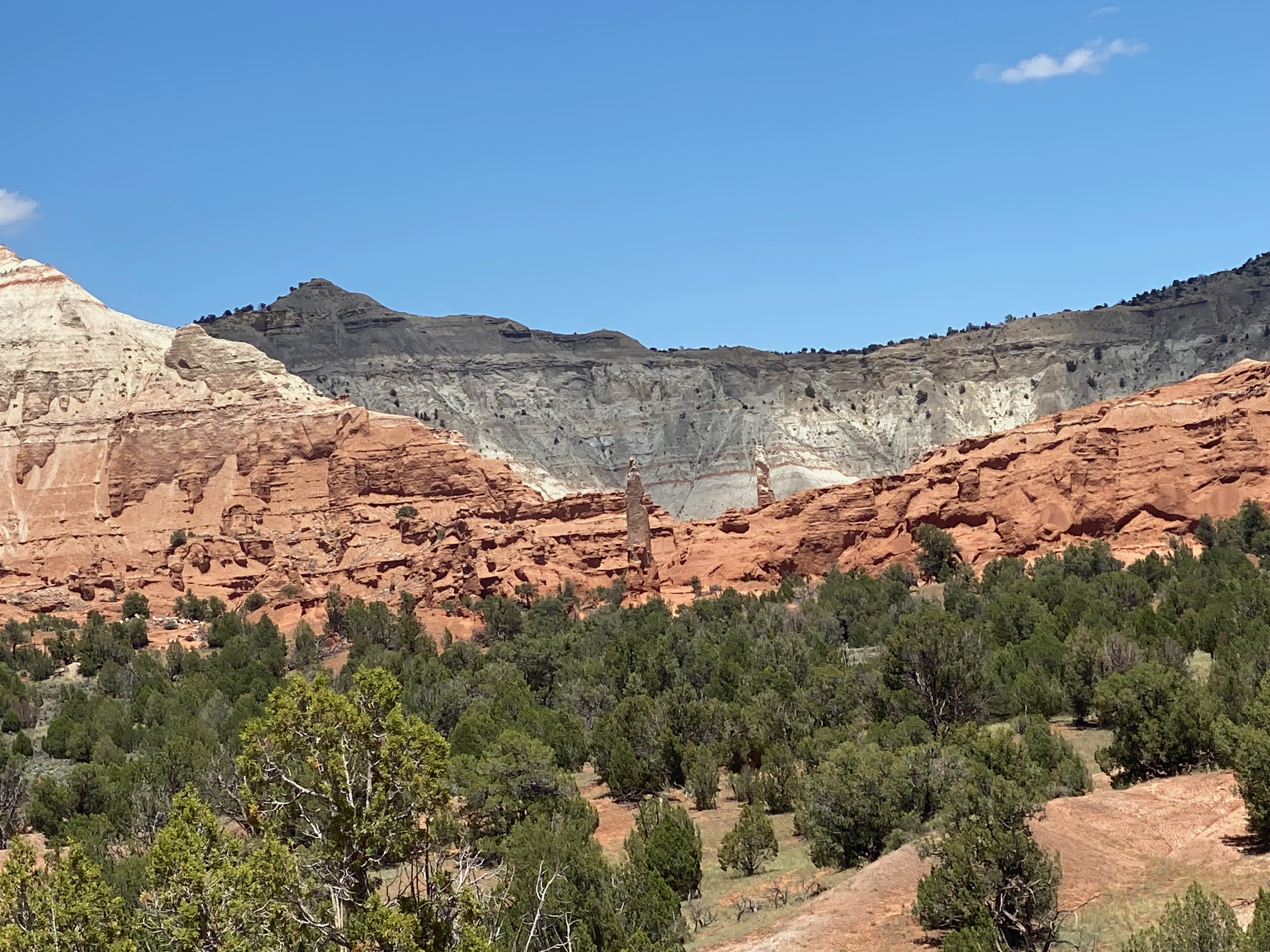
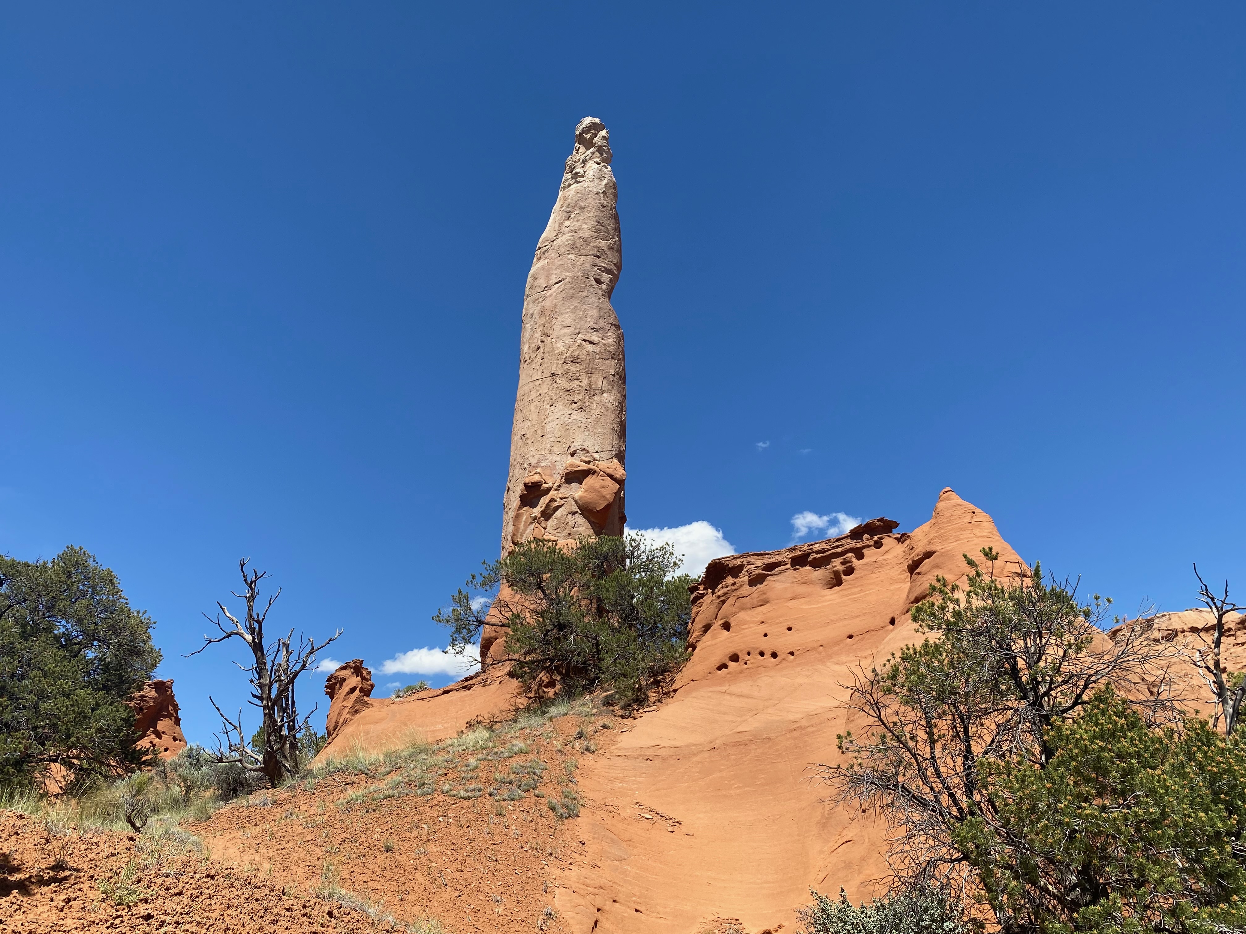
 We had been wanting to get to Kodachrome State park for years because of its reputation for incredible colors of the rock formations. It did not disappoint! We stopped at the visitor center to explore the shop and pick up some post cards after paying the entrance fee ($10) then drove out to Chimney Rock. The road out was dirt, but is reasonable shape and Bill and Pam’s SUV had no problems. We then headed back into the main part of the park and found a place to eat our lunch. The contrasting colors or the different layers in different formations was incredible. The Park also has 67 Sedimentary Pipes. There are several theories of how they were formed but basically the stone in the pipes is harder than the surrounding sand stone which eroded away from them. Pam found her and Lacy a comfortable place in the shade to read while Bill, Leslie, and David hiked the Panorama Trail (3.57 miles, 335 feet of elevation gain, 1060 calories burned) which took us on a loop around the Kodachrome Basin. The trail took us by a number of the sedimentary pipes, some of which had markings worn into them that were shaped like human hands. How many people had to touch there to cause those marks into the rock over time? The temperatures were higher than we expected, so we stopped frequently under trees to cool off. After the trail, we were ready for some cool showers so we headed for the RV Park. 

Entrance Sign

Chimney Rock


17 June 2023 Cedar Breaks NM

 Cedar Breaks NM is like a mini-Bryce Canyon but at 10,000 feet altitude. We drove into Panguitch and took UT143 toward Brian Head. That took us into Cedar Breaks NM from the east. We first turned up to the North Entrance to see the furthest North View Overlook and show the rangers our America Passes (Senior) and pick up park maps. The view looking down into the orange and red hoodoos is probably the best in the park. We worked our way south stopping at each of the overlooks to gawk. All the of the parks trails were still closed due to snow, over 10 feet in places. The wind was blowing hard up the canyon, so standing on the overlooks was a bit chilly. Even Lacy shivered. At the southern most part of the park, we went into the temporary visitor center (The new visitor center is still under construction) to get our passport stamps, post cards and other prized items. David talked with some of the rangers about access to the Bristlecone Pines in the park. Unfortunately, the trail to the grove was still buried under snow, but they told him about another grove of Bristlecone Pine grove in the Dixie National Forest. After we left the park, we turned on UT14 toward Cedar City. Just a short distance down the road was the trail head into the Bristlecone pines. Bill, Leslie and David hiked the short ¼ mile trail to the overlook. These were some of the must robust and tall Bristlecone Pines we have ever seen. They were huge and beautiful. From the overlook we also looked down into the valley that was the watershed for the Virgin River which flows into the Narrows and into Zion National Park. We could see Zion Canyon in the distance and the crack in the earth that is the Zion Narrows. Absolutely Beautiful! Following the Bristlecone Pine hike, we drove on down into Cedar City to stock up on some essentials. We then drove up to Tom and Shanna’s cabin above Cedar City. They have a beautiful log cabin with a view looking west over the city and in the distance we could see Wheeler Peak in Great Basin National Park. Tom and Shanna are doing great. We had a wonderful dinner and enjoyed catching up on how everyone was faring in retirement. We headed back to Hatch just before sunset on UT14. As it got dark, there were deer everywhere along the road and it was a slow nerve racking drive back, but fortunately we did not hit any. 


16 June 2023 Orderville

 The rain was coming down for a second day. We decided to go investigate the antique stores in Orderville after lunch. The town is fairly small, with only one real antique store. But there were also a couple of rock shops we stopped to investigate. It was a good chance to pick up some gifts for friends and family. We then decided to head over to a restaurant in Tropic that Bill had seen a sign for along the road. Unfortunately, when we got there we found out you had to have reservations. Seemed hard to believe in this tiny town. So we headed back into town and ate at the Showdown Restaurant. They had live music, good food, and good beer. It was a good way to end a fun day.