One of David’s must do’s was to ride the carriage roads in Acadia. The ranger had suggested the loop around Eagle Lake as a good moderate ride. David dragged his mountain bike out of the garage, which had been riding in the back of the Wanderer for 4 years without being used, aired up the tires, and oiled the dried-out chain before loading it up into the Behemoth. Our neighbors at the RV park had ridden the trail just a couple of days before and had said it had a couple of good hills on it but was a fairly easy ride. Again, David got lucky and got a great parking spot by the lake where the trails start and people were also launching canoes and kayaks (no paddle boards allowed on Eagle Lake). The carriage roads of Acadia were put in by the J.D. Rockefeller who used to like taking horse drawn carriage and horseback rides around the park. There are over 45 miles of broken stone carriage roads in Acadia for bike riding, horseback riding and walking. The carriage roads are 16 feet wide and very well maintained. The loop around eagle Lake is 6 miles with 340 feet of elevation gain. Not having ridden in four years, David felt every foot of the elevation gain. But it felt great to get back on the bike and stretch his legs again!
Sunday, August 14, 2022
10 August 2022 Paddling Long Pond
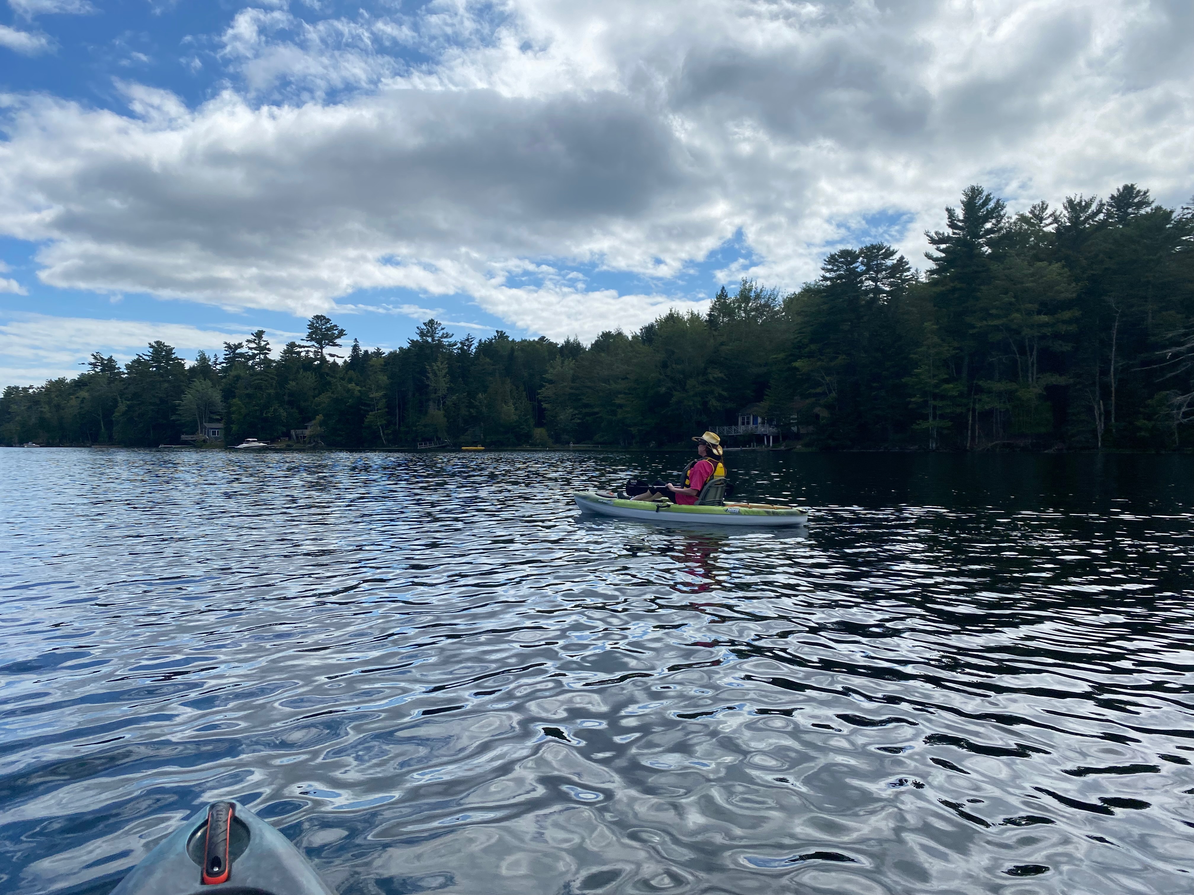
One of our must dos was to paddle one of the fresh water lakes in Acadia NP. The ranger had suggested Long Pond since it had easy access for launching. So we dragged the kayaks out of the garage along with all our gear and laded up the Behemoth. When we arrived at Long Pond, it was pretty busy at the launch with folks launching paddle boards, canoes and kayaks but we got lucky and got a parking spot up front. It was great to get back out on the water again since it had been months since we had the kayaks out. The weather was perfect with a light breeze, and temperatures in the 70s. The water was surprisingly warm and comfortable. This lake is also a drinking water source so no swimming is allowed. The water was incredibly clear and you could see the bottom at least 15 feet below our kayaks. David managed to get hung up on a rock pile in the middle of the lake but generally it was fairly deep. The lakes on Desert Island were carved by glaciers and are up to 150 feet deep. We paddled about halfway down the lake and back, enjoying the beautiful day and the serenity of paddling on the water. By the time we made our way back to the launch, our arms and shoulders were definitely feeling it. Getting into shore was a trick, since there were so many people and they don’t seem to take turns. It is every boater for themselves! Back at the wanderer, after washing down the kayaks, we decided that we needed to get back out again before we left.
8 August 2022 Cruising Acadia
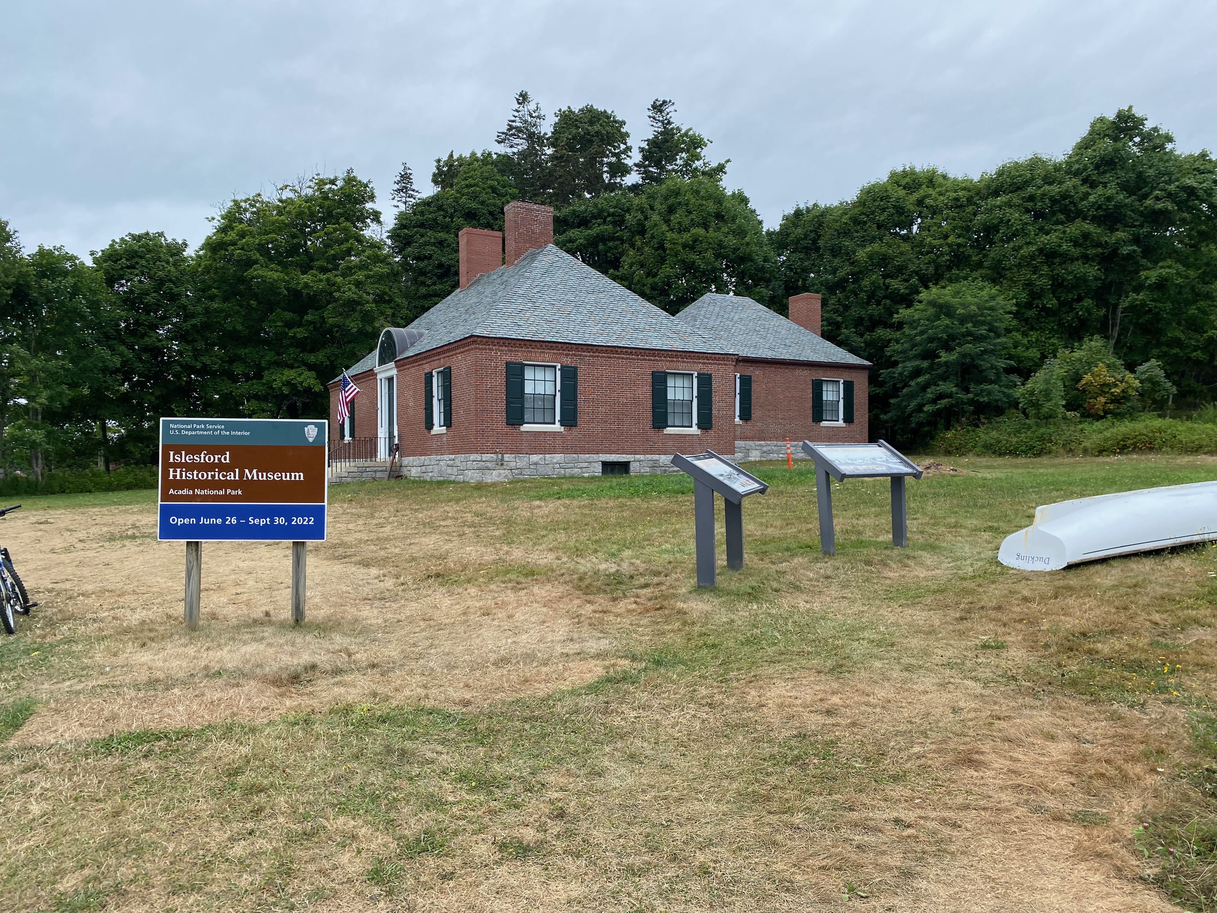
We decided we needed to see Acadia from the sea and took a tour boat (Sea Princess) out of Northeast Harbor. The cruise was about 3 hours long and was narrated by Winston a retired biologist from the Acadia Park Rangers. They took us past Sutton Island and the Light House on top of the cliff, then on to the Eat Bunker Ledge to see the harbor seals before heading to the small town of Islesford on Little Cranberry Island. There we were able to get off the boat and wander through the historic small fishing village. We made our way through town to the historic church built by shipwrights. The wood working was amazing. We also visited the small museum on the island run by the park service. Little Cranberry Island is one of the few islands still occupied year-round. They get their water from deep wells on the islands, but the power comes through under water cables. Back on board, we were given a lesson on lobster fishing. licenses are hard to come by for commercial fishing of lobster. The licenses tend to be passed down through the families. To even qualify for a license you have to put in over 1000 hours on a commercial lobster boat. Each licensee can deploy up to 800 lobster traps. But on a typical day, they can only service 200-250 traps. Each trap has to be brought up, emptied of the lobster, new bait of dead fish put in the “kitchen” and then lowered back down. You can only keep a lobster that has a cephalothorax shell longer than 3 ¼ inches from the eyes to the start of the tail, but no longer than 5 ½ inches. If you get one larger than 5 ½ inches you have to throw it back because it is a breeder. If you catch a female with eggs on her legs you have to notch her tail and throw her back, or if you find a female with a notched tail you also through her back. These rules are observed voluntarily by the lobster fisherman to avoid over harvesting like the cod decades ago. When you see the thousands of lobster buoys floating in the bay, you can understand how important the rules are to follow. Each lobsterman had their own distinct paint pattern on their buoys that are also passed down through the families. Lobsters can live up to a hundred years old and grow to more than 4 feet long. Another thing we did not know was the lobsters migrate between shallow water in the summer and deeper water in the winter. If you are a Maine resident you can obtain a license to run up to five lobster traps for your personal consumption. During the height of the Cod fishing period, lobsters were considered trash fish and were only served to prisoners. It was considered cruel to serve lobster to a prisoner more than twice a week. Thus, educated in the ways of the lobster, we headed into Somes Sound, the only fiord on the Atlantic coast of North America. The sound was carved by glaciers into a lake that later eroded to connect with the ocean. Acadia NP butts up against the sound on one side and huge 100+ room “cottages” of the rich and famous line the other side of the sound. Overall, it was a fun voyage. After we returned to dock, we drove around Somes Sound to Southwest harbor and stopped for an early dinner at Beal’s Lobster Pier. We decided to split a lobster dinner again, and Leslie had to pick which lobster she wanted out of the tank of live lobsters. We paid $19 a pound. While waiting for our cooked lobster to be brought to us, we watched the lobster boats unloading the day’s catch at the docks. Most were immediately loaded into waiting refrigerator trucks but we also saw people coming to the boats and buying the lobster right from the fishermen. It doesn’t get any fresher than that! Our fresh lobster was delicious!
Interior of Islesford church 
Islesford Church 
NPS Museum at Islesford 
Light House on Sutton Island 
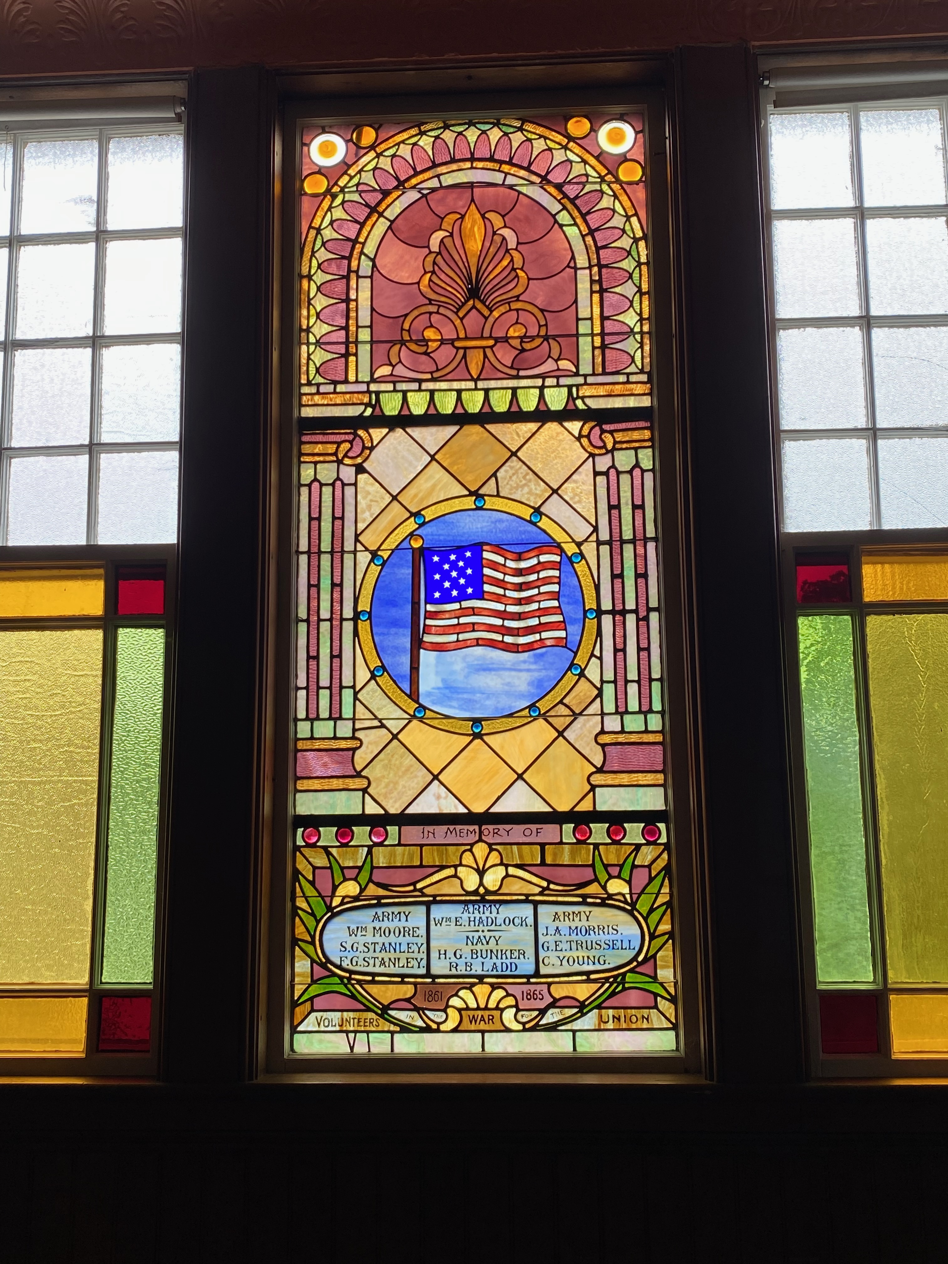
Stained Glass Window in Islesford Church 
Tide is low in Islesford Harbor 
Lobster Boat 
Cliff Face in Acadia NP 
Beals in Southwest Harbor 
Unloading todays catch 
Life of a Coast Guardsman
![]() |
| NPS Museum in Islesford |
![]() |
| Historic Boat House in Islesford |
![]() |
| Islesford Harbor |
![]() |
| Harbor Seals |
![]() |
| Chart of our voyage |
![]() |
| Sea Princess in Northwest harbor |
Sunday, August 7, 2022
6 August 2022 Jordan House
One of the quaint essential things to do in Acadia NP is to stop in at the Jordon Pond House for popovers and tea. When we started trying to make reservations back at the beginning of July, there were no afternoon reservations available for popovers and tea for our entire visit. So, we made dinner reservations instead. After driving for three days, we decided to just head out of the Wanderer until our dinner reservations. We were surprised to get lucky with a close parking spot when we pulled into the Jordon Pond House. Our previous drives into this parking lot found it full with lines of cars circling hoping to catch someone leaving. We stopped in the extensive gift shop to see what they had but decided we had already stocked up on our Acadia memorabilia. We checked in at the hostess and were told they were having a bee problem in the outdoor seating area and recommended we take a table inside. We were lucky and got a great table for two by the windows. We had a wonderful dinner and even got some popovers for dessert. After dinner we strolled out to the outdoor seating area with its beautiful view of Jordon Pond for some pictures. We did not have any issues with bees, but they were in the process of shutting down the outdoor seating area. On the drive back we tried to stop at the Bar Harbor vineyard for an after dinner glass of wine but were disappointed to find out they closed at 5PM.
![]() |
| Jordon House Outdoor Seating |
![]() |
| Window Seat |
![]() |
| Jordon Pond from Jordon Pond House |
5 August 2022 US1 South
We decided to take the long way back to Bar Harbor via US1. The highway follows along the St. John River all the way to the sea and we had some nice views into Canada and along the river. Eventually we connected into the stretch of US1 that we had driven on our way to Quoddy Head Light House. We stopped off at Chipman’s Warf again and stocked up on fresh sea food and a couple of Lobster Rolls for dinner. After three days of driving, we were very happy to come home to the Wanderer!
4 August 2022 Fort Kent
Our second and third goals for this excursion were to drive US1 all the way to Fort Kent. After a good breakfast at Governor’s, we headed north on US1. About a mile east of the town of Madawaska, we passed the Northeastern most point of the USA. It’s actually on private land up against the St. John River, the border between the USA and Canada in this area. That completes our extreme geographical location quest having now visited the Northwestern, Southwestern, Southeastern and now Northeastern most points of the USA. We continued on to Fort Kent and followed US1 through the small town until we came to the northern terminus of US1 at the Canadian border. So we have been to both extreme ends of US1 and quite a bit of US1 in-between. We had lunch at a restaurant, recommended to us by some fellow RVers, Rock’s Family Diner, right across the street from the termination monument. After lunch we climbed to the top of the levee along the St. John River and marveled at seeing a border without people trying to cross the river illegally! We then went to the historical Fort Kent. The fort was built in 1839 during the abortive Aroostook War with Briton (1938-1939) over the international boundary in the northern Maine. There were no major battles or combat casualties even though both sides mobilized 50,000 plus troops. The boundary between Canada and Maine, New Hampshire, Michigan and Minnesota was formally established in 1842 by the Webster-Ashburton Treaty. For being a 183 year old wooded structure, it was in great shape. We then headed over to the First Mile Brewery to indulging in some local beer before heading back to Presque Isle via the northern section of Maine 11 scenic byway. This stretch had a lot more open areas and the views were beautiful.
![]() |
| Marker for the Northern Terminus of US1 |
![]() |
| Marker for the first mile of US1 |
![]() |
| End to End of US1 |
![]() |
| St. John River (Canada is on the opposite bank) |
![]() |
| Fort Kent |
![]() |
| Stairway to second floor in Fort Kent |
![]() |
| Brewery Sign |
3 August 2022 Katahdin Woods and Waters NM
We had one last national park unit to visit in Maine. The Katahdin Woods and Waters NM is a fairly new park unit and does not even have a formal visitor center. There is an information desk in the Lumbermen’s Museum in Patten where we stopped to pick up a map and get our passport stamp. The park is not very developed yet and the hiking options are still pretty limited. We chose to go back to the southern portion of the park and do the 16 mile scenic loop. The road into the southern portion of the park is a gravel road maintained by private lumber companies. It was in fairly decent shape and every once in a while, there would be a sign to keep you going in the right direction. Portions of the loop road are not even in the GPS Navigators data base yet. Once we entered the park, it was clear that the roads were former logging roads but have had at least some maintenance. Not an issue for the Behemoth and we didn’t even have to go into four-wheel drive. Most of the scenic drive you are deep in woods with occasional low hanging branches. We finally came to the marked scenic overlook and drove up to the parking area. There we had an unobstructed view of Katahdin Mountain, the northern terminus of the Appalachian National Trail. As we pulled into the parking area, two other vehicles pulled in behind us. One of the occupants muttered “You damn well have to want to get here” as he climbed out. We agreed, the 32 miles of gravel road to get to this overlook were a bit rustic. Looking at the mountain from a distance, it seems like a rough way to end a 2200 mile hike. The mountain itself is in Baxter State Park and not part of the national monument. We broke out our picnic lunch and sat down to enjoy the view. After lunch we decided to continue around the scenic loop rather than go back the way we came. We had an occasional view of the surrounding wood hills but much of the drive was in deep woods. We did come across occasional trail heads that looked more like old logging roads. Eventually getting back to pavement, we decided to take Maine 11 Scenic Byway rather than the interstate to get to Presque Isle where out hotel was located. We did not bring the Wanderer up here because there were no RV parks in the area that could take it. We stayed at the Sure Stay (part of Best Western) in Presque Isle ($220 per night). It was the only pet friendly hotel in the area. The town of Presque Isle is pretty small and dining options were limited. After getting Etta settled in the hotel, we headed out to a Chinese Food restaurant recommended by the front desk. Service was extremely slow and the food was not worth the wait.
![]() |
| Scenic Loop Road |
![]() |
| Entrance Sign to Southern District |
![]() |
| Katahdin Mountain, Northern Terminus of the Appalachian National Trail at the top |
![]() |
| View to the South |
![]() |
| Picnic View |