Sunday, August 25, 2024

21 August 2024 Independence Rock State Historical Site

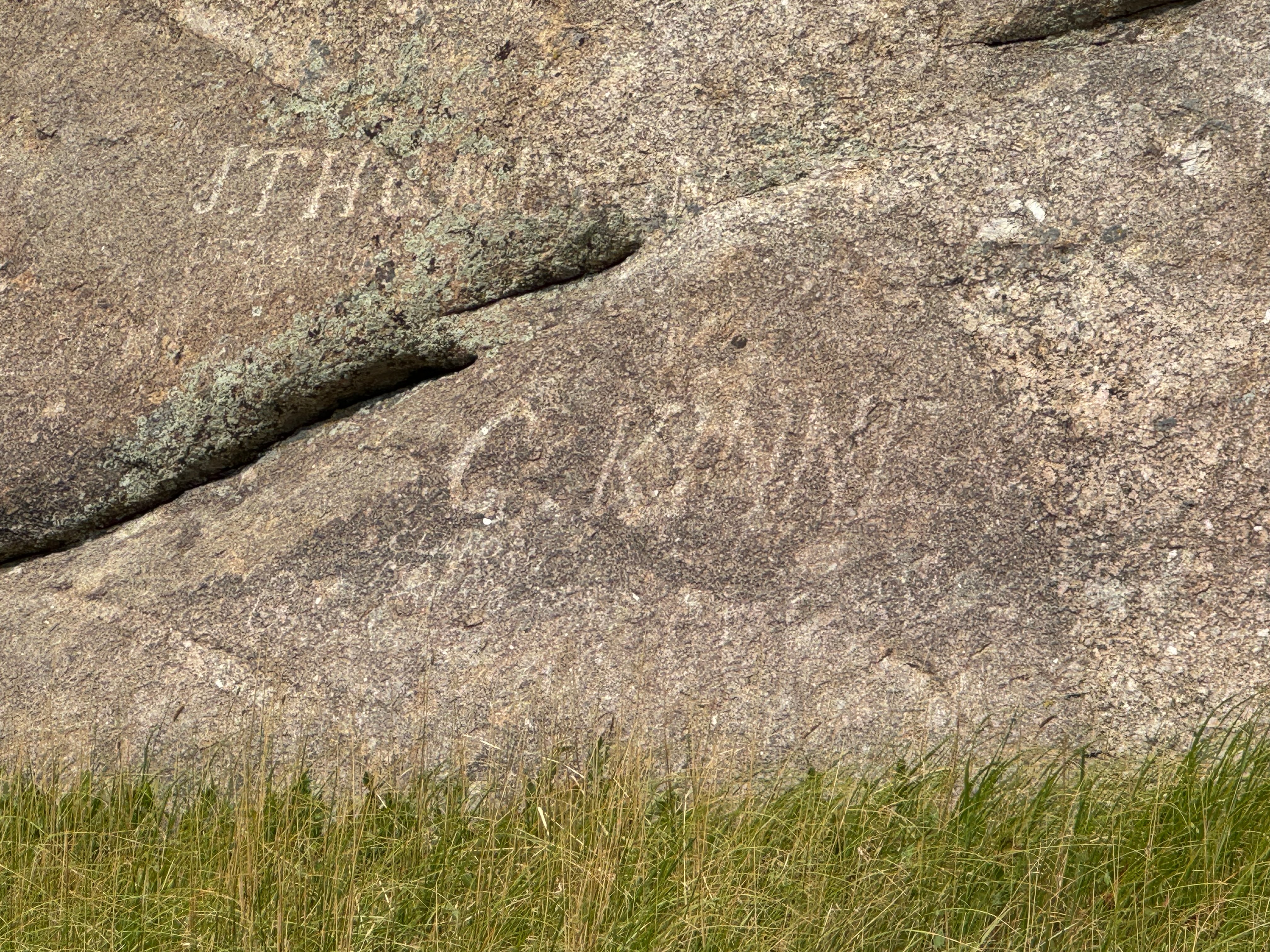
 While driving into Casper, we had noticed several signs for turn offs to Independence Rock. We vaguely remembered it had something to do with the Oregon Trail, so looked it up on line. After some research we decided it would be an interesting place to visit since we had visited other pioneer landmarks in Kansas (Scotts Bluff) and New Mexico (Inscription Rock). We loaded Keira up after lunch and drove the 61 miles to the site. We were surprised to find out it was also a highway road stop. The rock is a giant granite dome that was one of the navigation points for the pioneers on the Oregon Trail. The goal of the pioneers was to be at the rock by 4 July so they could make it through the mountains before the winter snows. Between 1849 and 1869, over 500,000 pioneers passed this point, usually stopping for water from the Sweetwater River which runs just past the dome. There are over 5,000 inscriptions carved into the rock from 1818 onward. Most are hard to see now between weathering and moss growth. Many were done with axle grease and dirt which have since weathered away. But the University of Wyoming did a laser scan of the dome and were able to distinguish many inscriptions that can no longer be seen with the naked eye. The rock got its name when one of the early wagon trains stopped here on 4 July and had an Independence Day celebration. We walked the trail all the way around the base of the rock (1.5 miles) with Keira. We saw some people early on in our walk on top of the rock. As we walked around the far side of the rock it started to rain big cold drops intermittently. The clouds did not look threatening and since we were about as far away from the Behemoth as we could be, we just resided ourselves to getting wet. Keira really did not like being in the rain. We considered climbing up on the rock for the view, but could see lightning in some of the storms in the distance and decided we did not want to be on top of a granite dome in case lighting came closer. There was no visitor center for the site and many of the signs had been vandalized. Given the history, we were surprised this had not been made a National Monument yet. After we finished the trail we headed back home thinking about those intrepid pioneers that faced so many hardships in their journey.

Independence Rock Sign

Inscriptions on Independence Rock

Keira at Independence Rock

Inscriptions on Independence Rock

Inscriptions on Independence Rock

Inscriptions on Independence Rock

Inscriptions on Independence Rock

Inscriptions on Independence Rock


20 August 2024 Casper Mountains

When researching the Casper area, we noticed there was a road that went up into the mountains south of Casper and thought it would be a scenic drive. So we loaded Keira up and drove the Casper Mountain Road from town up into the mountains. There was a nice scenic view from the top of the roads climb with views of Casper and the rolling plains to the north. We followed a side road to the Hogadon Ski Area. It kind of reminded us of Wolf Creek with the Ski Lodge at the top of the mountain. We then followed roads here and there into the national forest before taking Circle Drive out to WY487 before heading back into town. It was a fun little excursion. 


19 August 2024 Hermosa, SD to Evansville, WY

 This was a 256 miles in 6.5 hours day. We took US385 south out of the RV Park to the town of Chadron Nebraska where we turned on to US20 west. US20 West connected to I-25 which we took north to Evansville, just outside Casper. The drive across the rolling plains of South Dakota, northwest Nebraska and South East Wyoming was picturesque. You could see from horizon to horizon. We are staying at Rivers Edge RV & Storage ($50 per night, no discount). The RV park is on the banks of the North Platte River with a great walking/pet area along the river banks. But the mosquitos along the rivers are fierce! A real war zone!

Rivers Edge Site

North Platte River


17 August 2024 Kayaking Stockade Lake

 One of the bucket list items for us was to go kayaking on one of the Mountain Lakes in the Black Hills. This morning we dragged the kayaks and paddling gear out of the garage and loaded up the truck. Our plan was to drive up to Sylvan Lake, paddle for a few hours, then have a picnic lunch. All was going well until we got to Sylvan Lake. The area was swamped with thousands of people! The large parking lot and the huge overflow (gravel) parking lots were completely full with a bunch of cars circling for someone leaving. Even the sides of the access road were packed. The shore was lined with people swimming and fishing., the lake was full of kayaks, bards, and canoes.  We decided, although this is probably the most scenic lake, that there were too many people. So, we drove back into Custer and made our way to Stockade Lake. There was a boat ramp that we could use to put in and it had some nice scenery. As we were unloading and getting the kayaks ready to go, Leslie slipped on some gravel on the boat ramp and fell. She landed on her left butt cheek and left wrist. After standing up and walking around, she decided it was ok to continue. We got out on the water and started paddling around. It felt so good to be back on the water. The lake was pretty clear and we could see the bottom down to about 10 feet. There was one power boat on the lake that some kids were wake surfing behind that stirred up some big waves that we had to watch out for. Otherwise, it was a quiet and peaceful paddle. By the time we got back to shore, Leslie’s wrist and hip were really hurting! It did not look like anything was broken, but definitely a sprained wrist and deeply bruised butt cheek. After a few Advil, we drove over to a picnic area overlooking the lake and had a wonderful picnic lunch. Then it was back to the Wanderer to unload the truck, wash down the equipment and loaded it back into the garage. 


Sunday, August 11, 2024

9 August 2024 Needles Hwy

 One of the things we did not get to do here the last time was drive the Needles Highway. The Highway has three one lane tunnels along its length. One of them is only 8 feet wide, the same width as the back of the Behemoth. The other two are just a few inches wider. So, driving the Behemoth through was a no go (yes, people get stuck in these tunnels all the time driving vehicles too big for the tunnel) and since the road is very narrow two way with no space to turn around, we were not even thinking of trying it. But Leslie came up with a great idea that would satisfy one of our other desires, rent a Razor All Terrain Vehicle in Custer, drive the Needles Highway and then take it off pavement for some fun four wheeling. Today promised to be the perfect day to do it with temperatures in the mid-sixties and no rain in the forecast. We drove up to Custer, arriving a bit after 2 PM, and picked out Adventure Rentals. We were able to rent a two seat Razor XP 1000 ATV. They normally rent for half days from 2PM to 6PM, so we were a little late. Total cost (not including gas) was $297. We were getting a late start, but the staff assured us we could do what we wanted if we hurried. After filling out the forms, coordinating with the staff on a good route with some fun off pavement trails, and getting our safety briefing, we jumped in our Razor and took off. One of the things we sort of expected but had not prepared for was that these things are VERY LOUD! Even though it has a muffler, it did not sound like it and the engine is right behind the seats. We almost could not talk to each other. Another thing was there is a fair amount of heat coming off the engine. The cockpit was tight for David, but workable. We drove from Custer, back into Custer State Park where we picked up the start of Needles highway. The Razor was able to get up to 55mph on the road, which was incredibly loud but a little nerve racking. Cruising along the Needles highway at 25-35Mph was more pleasant. We drove along the Needles highway with a lot of motorcycles since the Sturgis rally was still going on. Driving the Razor through the narrow tunnels was a breeze. There was no way we would have gotten the Behemoth through unscathed. We stopped along the route for pictures and to give our ears a break. We also took the time to scout out Sylvan Lake area since it seemed like a good place to go Kayaking. The drive was gorgeous and well worth the effort to see it. We drove the rest of Needles highway until it intersected US385. The last 8 miles were through Black Hills National Forest. We headed south on US385 and turned off onto Spring Creek Road which took us off pavement back into the National Forest. The first several miles were easy gravel roads which we could have taken the Behemoth on if we wanted. Then we turned off onto some dirt tracks that the electronic pad navigation map they had given us showed would take us to the top of Bear Mountain (7,165 feet) , the highest outlook in the area. The trail quickly became more challenging but the Razor made it seem simple. Between the great ground clearance, off road suspension, excellent traction and low end torque, it easily climbed us up the side of Bear Mountain to the top where there is a forest service watch tower. We are very impressed on the off road capability of the Razor as we don’t think we could have made it with any of our previous four wheel drive vehicles and definitely not with the Behemoth. As we got to the top of Bear Mountain around 5:30, the ranger was coming down out of the watch tower and locking up. So, we could not go up on the watch tower deck to take in the view, but we walked around and climbed up as high as we could in the tower to get pictures. Leslie took over driving the Razor as we headed back to town. We drove the dirt and gravel roads down to US16, then screamed along US16 at 55MPH (and finished off our hearing) back into town. Leslie really enjoyed driving, especially since the dirt road back was pretty smooth and it was fun to bump up the speed a bit! We stopped to refuel the Razor (it only used 4 gallons) before turning it back in. We were late arriving back at Adventure Rentals about 6:25. But they graciously waved us into the wash up area and checked us back in. They seemed surprised we were returning the rental with no damage to it! We tried to get a copy of our route off the electronic pad with the maps, but it seems to have gotten lost in the transmission. After completing our drop off, we walked across the street to the Wolf Bar and Grill to have dinner. The food was surprisingly good for a small town bar and grill. On the way home, we saw numerous deer near the road. 

Our Razor XP 1000

Cathedral Spires


Narrow Tunnels


Sylvan Lake


Monday, August 5, 2024

3 August 2024 Hot Springs

 It was shaping up to be another hot day. But we decided to drive down to Hot Springs South Dakota to the south of where we are staying. Part of it was to scout the road for when we pull out in a few weeks. We went to the Mammoth Bones site where they have unearthed the bones of 61 mammoths that had fallen into a sink hole and could not get out over 140,000 years ago. Once we were in the museum, we remembered that we had been here in 2018, but it seemed like they have excavated a lot more area since that visit. We then drove down to Cascade Falls State Park where a spring fed stream flows over a series of cascading falls. It’s a popular place for local people to go and soak in the cool water on a hot day. There were several tourist busses there as well. We did not go into the water, but enjoyed watching the folks playing in the falls. As we headed back, we stopped at a smaller park where the springs that feed the stream come up out of the ground with cold clear water. Since it was getting late, we drove through the town of Hot Springs looking for a place to have dinner. The streets in the downtown area were all torn up with construction and most of the shops and restaurants were closed. So we ended up going back out to the Mammoth Bone site area where we had noticed a Mexican Restaurant that looked like it had recently opened, Jalapeno Grill. It was surprisingly good for a Mexican Restaurant north of the Red River. 

Mammoth Bone Exhibit.


Cascade Falls

Cascade Spring


1 August 2024 Iron Mountain Loop

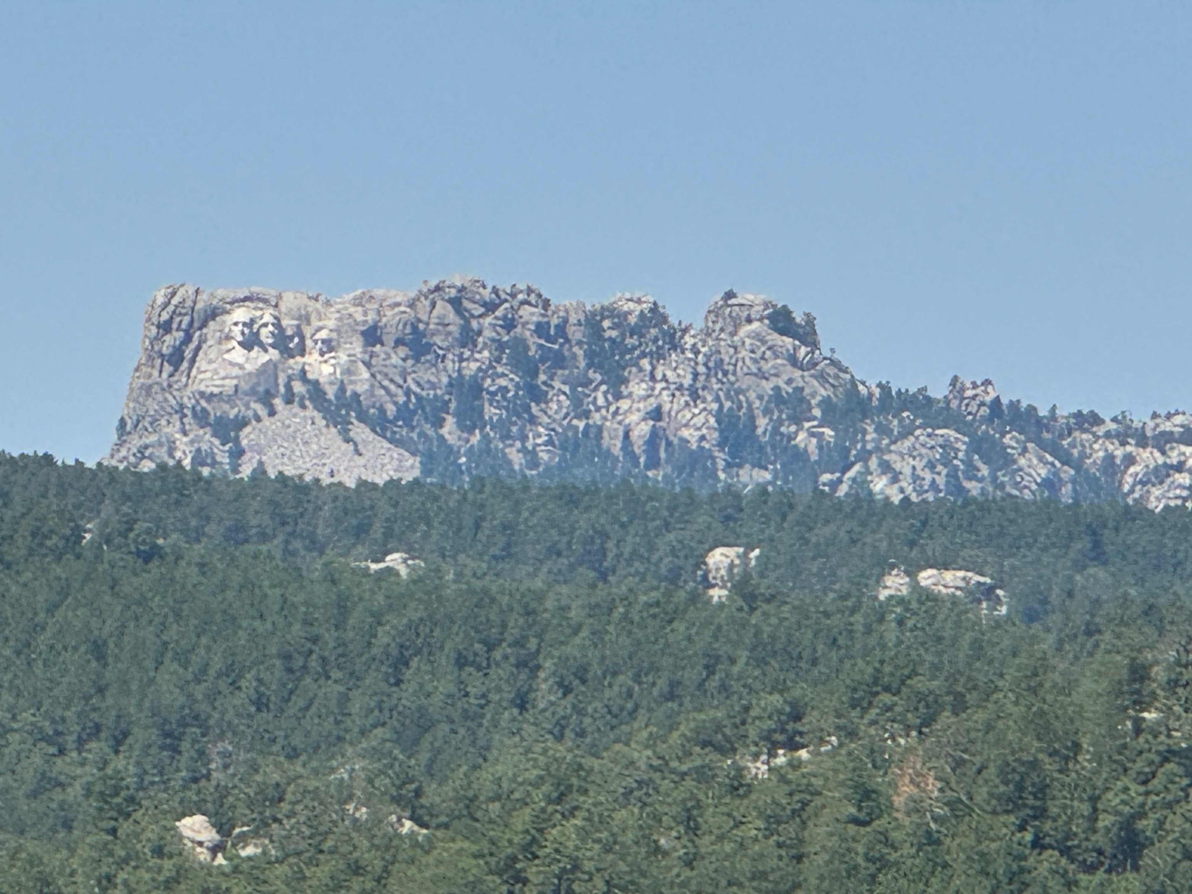
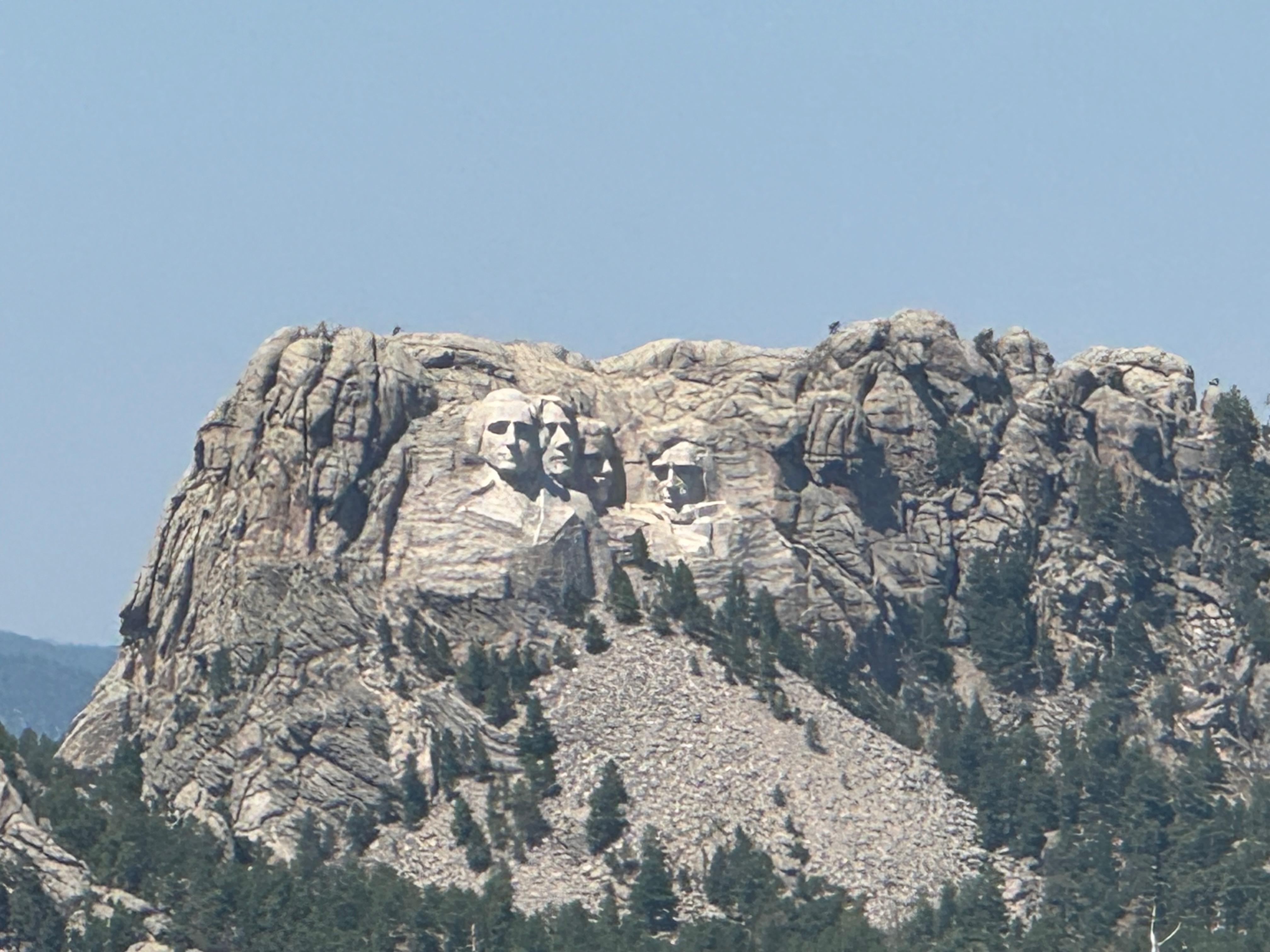
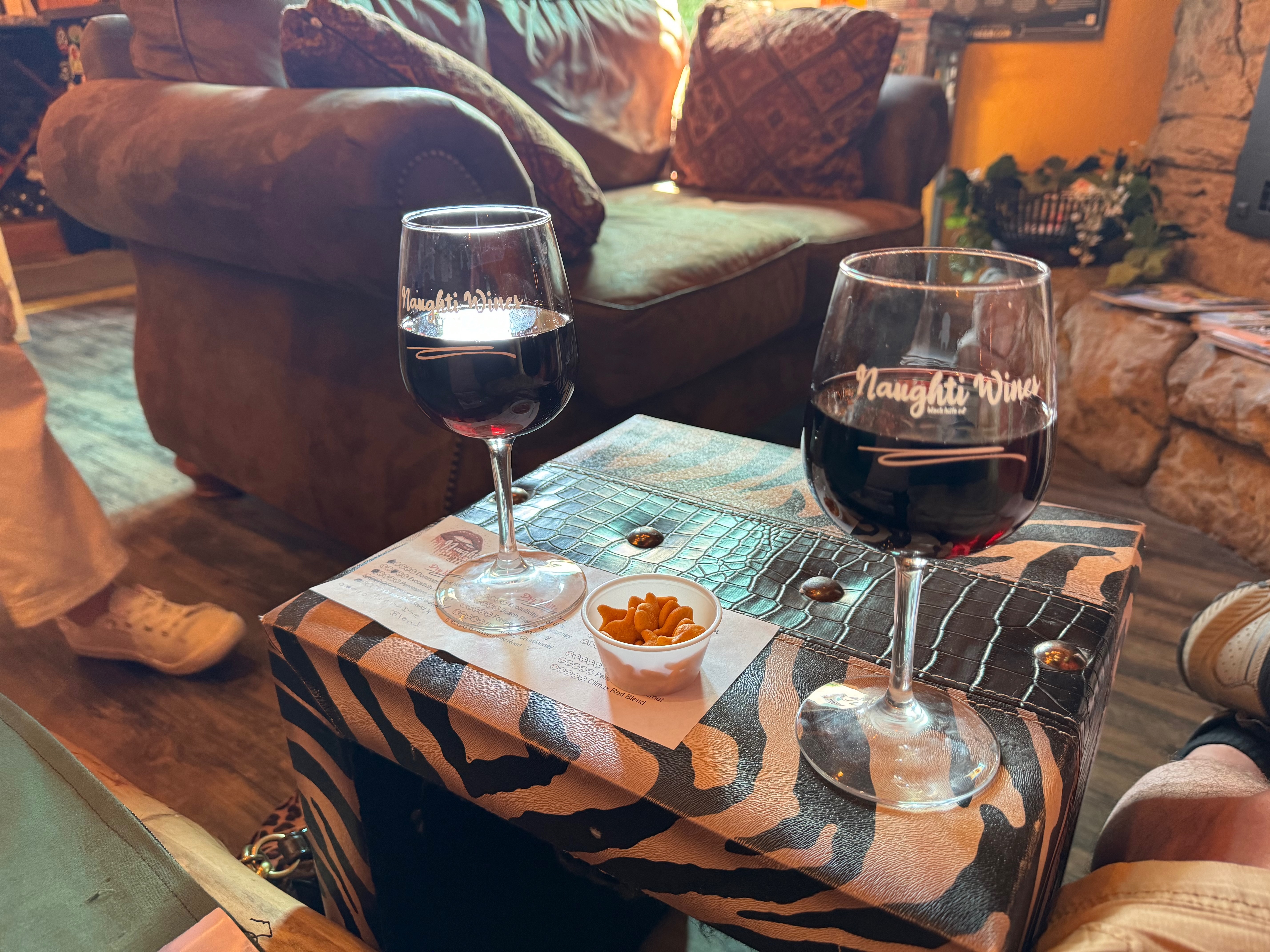
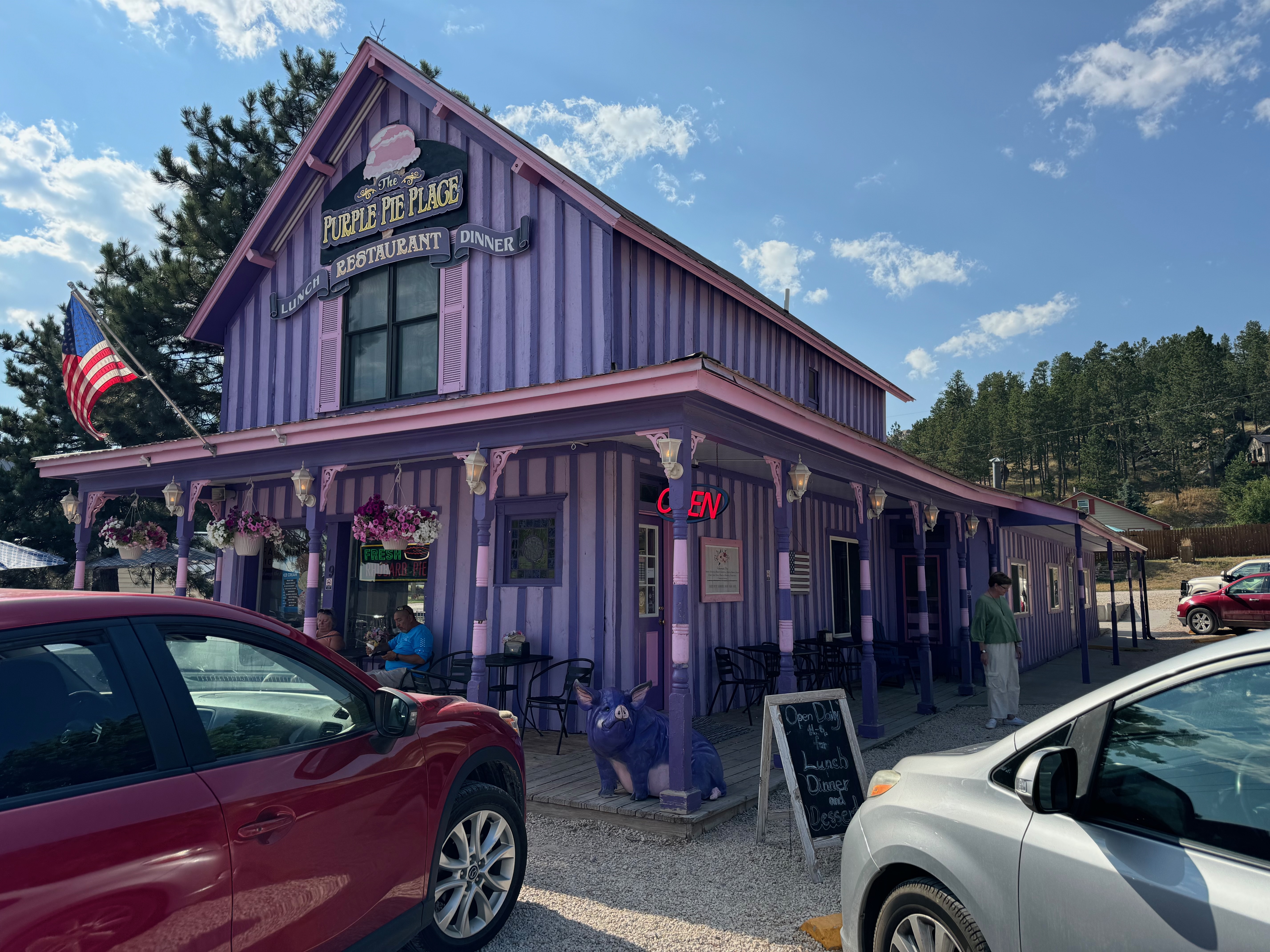
 The heat has been oppressive the last few days with temperatures over 100F with afternoon thunderstorms which has limited our activities. We don’t like leaving Keira alone for more than a couple of hours in case the power goes out in the RV park due to the heavy demands from all the air conditioners and definitely not when thunderstorms are blowing through. But today seemed like a reasonable day to head out. We decided to drive a loop over Iron Mountain into Keystone, then over to Hill City and back through Custer. We picked up Iron Mountain road just inside Custer State Park. It is a paved narrow winding road up to the top of Iron Mountain with views of Mount Rushmore. There are three one lane tunnels we had to pass through that were only 10 feet wide while the Behemoth is a little over 8 feet wide. So a close squeeze. There were a lot of motorcycles on the road even though the Sturgis Rally doesn’t start for two days. Some of the tighter turns were a bit scary with the Behemoth taking up the whole lane and sticking out over the center lines with motorcycles zooming around the corners very close to or even over the centerline. There were a couple of close calls that we’re sure scared them as much as it did us. There were also two pigtails we had to drive through coming out of one lane tunnels that were fun to negotiate. We stopped at several over looks to enjoy the scenery and the views of Mount Rushmore. We dropped into the small town of Keystone where we ate lunch on the edge of downtown. The downtown area was a sea of motorcycles and riders. After lunch, we headed on over to Hill City where we stopped at Naughti Winery where we did a wine tasting and relaxed with a glass of wine. The dry red wines were surprisingly good, but all of their grapes come from the Columbia River Valley, none are from South Dakota.  We drove through downtown Hill City and found the largest Smokey the Bear we had ever seen! From there we drove down to Custer and stopped at the Purple Pie Shop and each had a slice of delicious homemade pie for dinner (Leslie had Peach and David had Blueberry). As we were leaving Custer and heading back to Hermosa, we got lucky enough to see a beautiful doe and 2 twin fawns on the side of the road. The fawns were small and still had their spots!

Mount Rushmore from the top of Iron Mountain


Motorcycles lined up on Main Street of Keystone

Wine Tasting at Naughty Wines


Purple Pie Shop

Going through a tunnel on Iron Mountain Road


Now that is a BIG Smokey the Bear!