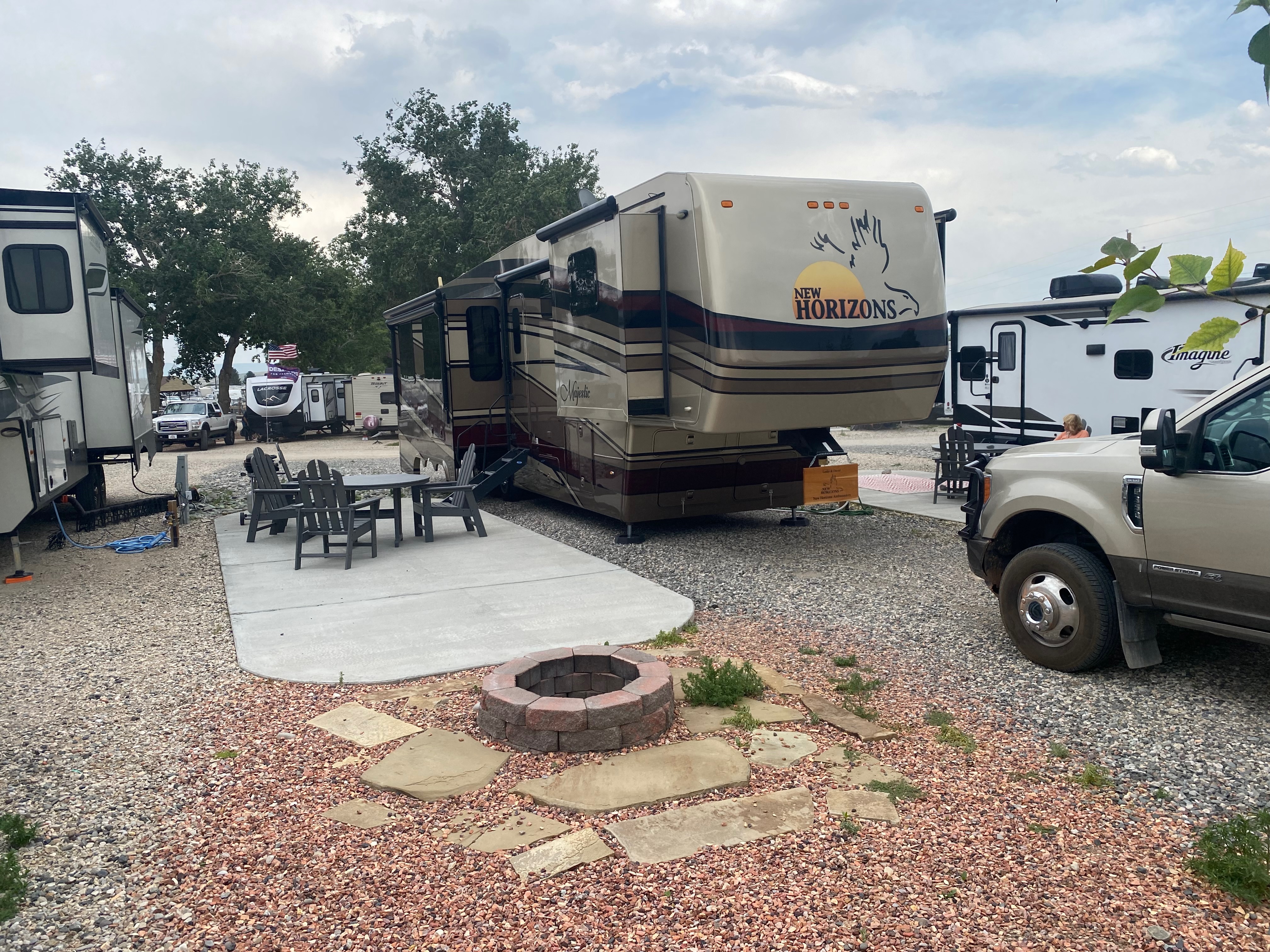
The drive to Cody was through more of Wyoming vast prairies. The one exciting part was the drive through Wind River Canyon where we had to pass through three 14 foot tall tunnels. The first two were easy since there was no oncoming traffic so we took the center of the road to drive through the tunnel. The last one was tricky since there was an oncoming semi-truck and a curve in the tunnel. But we made it though without scraping anything! We are staying at the KOA ($80 a night with KOA discount) in Cody. After getting set up, we decided to go into town for dinner. We went to Trailhead for dinner. We did not have a reservation and they were packed. But we were able to get a couple of seats at the bar. While talking to the people next to us, we found out they were from Weatherford and were in town for the gun show. They own Teskeys Saddle Shop. After talking for a while, we went to check out and they insisted on buying our dinner because they liked our story. Everyone envies our lifestyle and have so many questions.
Thursday, July 13, 2023
10 July 2023 Sinks State Park
With the weather turning nice, we headed for Sinks Canyon State Park, just west of town. In the park, the Middle Popo Agie River goes into a large underground cavern for ½ mile and then flows back out. The entrance to the cavern is pretty large. They don’t know the actual path of the water since the cavern is chocked with rock and tree stumps from flash floods. It takes the water 2 hours to travel that ½ mile before it bubbles out of the ground into a large pool before continuing down the canyon. They have conducted dye tests confirming the same water going in is coming out at the Rise, but additional water is present and they can’t figure out where it’s coming from…mystery! In the pool are hundreds of very large trout that had worked their way up stream (they could not have survived going through the cavern) to spawn and stayed because the pool does not freeze over and there is a good food supply. They do allow you to buy food for a quarter to feed them from the overlook. After taking in the Sinks, we continued up the road into Shoshoni National Forest/Wind River Range. The road turned into dirt, with lots of pot holes, and we continued on for 19 miles (until it intersected WY28). We passed some beautiful alpine lakes and stunning mountain meadows. We got cut off at one point by an impulsive deer determined to cross the road in front of us(It almost ran into us)! We also saw a large Blue Heron, and a fair number of camp sites where folks had pulled their RVs (16 day max stay) to boondock.
![]() |
| Middle Popo Agie River |
![]() |
| Entrance to the Sink |
![]() |
| Description of the cavern |
![]() |
| Exit from the sink and all the Trout |
![]() |
| Frye Lake |
![]() |
| Fiddler Lake |
9 July 2023 South Pass City
After yesterdays rains, we took our time getting out to give the roads a chance to dry out. We headed back west to South Pass and took a well-maintained gravel road to historic South Pass City. A former mining town, the town has been a ghost town since the early 1930s when the gold mines shut down. We were surprised as we pulled up to the town to find out they were having their Gold Rush Festival. Our great luck! So we paid our entry fees and strolled through the old historic buildings, vendors, and food trucks. We watched as they blew an anvil up into the air and robbers road into town shooting their guns in the air and robbing The Exchange. People were down in the creek panning for gold, live western music, live demonstrations of pioneer crafts, and plenty of historic photos to enjoy. After the Festival, we went up to the Carrisa Gold Mine (now owned by the state as a historic site) and took a tour of the mine machinery buildings. The mine itself, five levels going 496 feet deep, is now mostly flooded. The mine first started operations in 1868 and went through several boom and bust cycles before finally closing in 1949. The only owners that made money from the mine was the first owners in the 1860s. Every owner since has lost money. The gold is mixed in with iron and other minerals and it took over 2 tons of rock to get ½ a once of gold. The mine had to run 10-14 days to produce one 80 once gold bar worth $2500 in the 1940s. Back then you were only allowed to sell gold to the government and they set the price. It was interesting to see the process and machines for extracting the metal from the rock. On the way back to the Wanderer, we took a dirt road through Red Canyon. It was beautiful! The road was in pretty good shape after the rains although we did have to crawl through a couple of muddy/flooded areas that coated the wheels with red mud. They almost look rusted.
![]() |
| South Pass City |
![]() |
| The Original RV |
![]() |
| Panning for Gold |
![]() |
| The Bar |
![]() |
| Main Street |
![]() |
| Frontage |
![]() |
| The Switch Board |
![]() |
| Miner coming into town |
![]() |
| Another Bar |
![]() |
| Entrance Sign |
![]() |
| Carrisa Gold Mine |
![]() |
| Winch Building |
![]() |
| Processing Building |
![]() |
| Processing Building |
![]() |
| Red Canyon |
![]() |
| Red Canyon Cliffs |
![]() |
| Red Canyon Cliffs |
![]() |
8 July 2023 Pioneer Village Museum
With big storm clouds building over the Wind River Range, we decided to stay on the paved roads. So we went into town and ate lunch at a local café. Then we headed over to the Pioneer Museum and walked around the historic buildings that had been moved there. They were in the process of setting up for an outdoor wedding, but as we walked around we were getting hit by occasional drops of rain. We then went into the Fremont County Historical Museum next door. But after peeking into the museum we decided it was not worth the $12 entry fee.
![]() |
| Double Rainbow |
7 July 2023 Rock Springs to Lander WY
The drive from Rock Springs to Lander took us over the South Pass of the Rocky Mountains. The South Pass of the Rockies is where the Oregon and Mormon trails cross over Rocky Mountains as the only wagon friendly path. We crossed over the Great Continental Divided headed east for the first time since crossing on 17 April on our way west. We were climbing up through the wide open Wyoming prairie the whole way. The only time we saw trees was when there was a ranch house or a small town along the route. None of the climbs were steep, but the steady climb for over a hundred miles did heat the transmission up, but not close to an overheat at any point. We are staying at Twin Pines RV Resort ($51 with GSC) about two miles outside of Lander. We are at the base of the Wind River Mountain Range.
Thursday, July 6, 2023
5 July 2023 Provo Utah to Rock Springs Wyoming
After 3 months of moving west, we turned our sights back east today. We took US189 up through the Wasatch Mountains to I-80. There was a lot of climbing and the Behemoth did fantastic as usual. We got stuck in a traffic jam, due to construction, on a steep climb and the transmission oil temperature climbed up to 243 for 5 minutes, but stayed below the overheat level. As soon as we got moving again the temperature dropped quickly. We’re staying at the Rock Springs KOA ($79 per night with KOA discount) just west of town. We were really surprised to see how big Rock Springs was. It has a lot more amenities than we expected and we stopped in the Chicago Pizza restaurant for an early dinner. The town is sustained by Oil and Mining work in the area. It seems to be a regional hub.
![]() |
| Rock Springs RV Site |
1 – 3 July 2023 Timpanogos Cave NM
One of our primary reasons for coming to Provo was to visit the Timpanogos Cave National Monument. It’s actually three caves, Hansen Cave, Middle Cave and Timpanogos Cave all tied together by manmade tunnels. The Hansen cave was discovered in 1887, and the other two were discovered in 1921. The caves are located high up on Timpanogos Mountain. The Trail to the cave entrance climbs 1080 feet in 1.5 miles. Before we arrived in Provo, we got on the website to reserve a tour but were surprised to find they were sold out through the entire time we were going to be in Provo. On Friday, we drove up to the NM to at least see the visitor center and check if there were any cancellations. After exploring the visitor center and collecting our passport stamp, we talked with the rangers and were told the reservation website had the same information they had for any cancellations. Disappointed, we decided to drive up into Provo Canyon on SR92 and then drop down into Sundance before heading back to the Wanderer. The views climbing up Provo Canyon were beautiful but the road is a bit narrow for the Behemoth. We spent the time getting the Wanderer and Behemoth cleaned inside and out. David kept checking the website and we got lucky and snagged two tickets from a cancelation on the 3rd. The ticket gives you the time you should leave the visitor center in order to reach the entrance at the desired time. We arrived 15 minutes early since we knew we would need some extra time given the steepness of the trail. After our safety briefing about falling rocks (and yes we saw rocks fall while we were on the trail) we started the trudge to the entrance. Fortunately, it was midmorning and the temperatures were pretty comfortable. There were a lot of fitness folks hiking the trail as well. As we were climbing, we could see storms building in the valley below and starting to head toward us. We were encouraged to see much younger people than us huffing and puffing on the trail as well! The last half mile is the steepest with over 400 feet of altitude gain. As we came within sight of the entrance, our energy was flagging. Then there was a loud clap of thunder overhead, and the thought of being on that exposed trail with lightening around gave us a renewed burst of energy! We almost sprinted to the shelter at the entrance! We had no time to rest before they pushed us into the cave entrance and closed the door. The temperature dropped immediately from the warm 75 degrees outside to 45 degrees inside. So, we pulled out our sweat shirts and bundled up our sweaty bodies. After that climb up, we had high expectations for this cave system. We spent about an hour following our ranger guides through the cave system. There was more climbing up and down stairs and squeezing around rocks trying not to touch anything. We were really not impressed overall. Part of Hansen Cave had been mined early on. The other formations were typical of caves and not as nice as we have seen in other caves. The one new thing is Helictites, which we had not seen before in other caves. With all the stooping, climbing up and down and around inside the caves in addition to the climb up, we were feeling the exertion! After we exit the caves, we were unhappy to find that we had to climb even more to get back to the trail to head down! The walk down was almost as tiring as the walk up and we ran out of water about half way down (Total:3.55 miles, 1457 feet of altitude gain, 1156 calories burned). All in all, a fun day, but the cave was not worth the effort compared to the many others in the NPS system. However, as we were driving out traffic stopped as a momma big horn and her baby walked toward us on the road. Realizing traffic was building they jumped up the embankment and disappeared. Now that was worth it!
![]() |
| Mountain Goats on the road |
![]() |
| Entrance Sign at visiter center |
![]() |
| Entrance sign on the road |
![]() |
| Stream in Provo Canyon |
![]() |
| Heart of Timpanogos |
![]() |
| Helictites |
.jpeg)