Tuesday, May 9, 2023

8 May 2023 Rock House Valley Road

 The other road we wanted to drive was the Rock House Valley primitive road into Vermillion Cliffs NM (BLM Run). One of our bucket list trails, Buckskin Gulch (longest slot canyon in the world), is accessed off this road. Reviews also showed this road is impassible when wet and based on the ruts we had to deal with, we could believe it. The road from US89 to Buckskin Gulch trail head was in good shape. After looking at the information for Buckskin Gulch trail, we headed on down to the Wire Pass trailhead. When we do hike Buckskin Gulch, we will probably do it from the Wire Pass trailhead since it cuts a couple of miles of open desert hiking. The parking area at both trailheads are very large. The Wire Pass trailhead is also where you access the Wave from. We tried to win the lottery for The Wave permits 12 times with no success. We decided to put off hiking Wire Pass to give Leslie’s ankle more time to heal as it is getting better every day. We stayed on Rock House Valley Road until it intersects US89A. Since we were pretty close to where our next campground was, we headed west on US89A to Jacob Lake where US67 and followed it down to the campground before turning around and heading toward Lee’s Ferry. We are going to have a 4500 foot climb from Lee’s Ferry to Jacob Lake with the Wanderer on Monday, so the Behemoth is going to get a workout. At Lee’s Ferry, we went down to the Colorado river and explored the historical area. Lee’s ferry is part of Glen Canyon National Recreation Area but when you walked down to the river, you enter Grand Canyon National Park. We then headed back to Page. The Vermillion Cliffs are incredibly rugged, colorful and spread out further than we expected.  Awesome in the late afternoon sunlight!
Rock House Valley Road

Entrance Sign

Colorado River at Lee's Ferry

Lee's Ferry

Colorado River and Vermillion Cliffs

Balanced Boulder

Extra Large balanced rock


7 May 2023 Cottonwood Canyon Road

 When we were driving around last week we noticed the Cottonwood Canyon Road heading north from US89. A little research showed this primitive dirt road runs up to the southwest corner of Grand Staircase Escalante NM (BLM Run). The road runs all the way up to Kodachrome Utah State Park entrance road. Since we wanted to give Leslie’s ankle a rest, we decided a drive today we be good. The weather was clear and dry which is important since this road is impassible when wet. Several reviews confirmed we did not want to be on it if there was a chance of rain. We stopped at the BLM Visitor Center and confirmed the road conditions and to pick up a map and suggestion for stops along the road. We drove the Cottonwood Canyon road 30 miles to the Grosvenor Arch. There were three places where the road grade was 20+% where we dropped into four-wheel drive to make sure we had enough traction to get up. We stopped at the 95 million year old Oyster Beds, then the Lower Cottonwood Canyon Narrows and walked into the canyon until a boulder wall block progress. As we drove up the road we came across three cowboys herding a group of cattle up the road. We followed along behind, intimidating the cattle to keep moving, until we were waved through by the lead cowboy. We also stopped at Grosvenor Arch. We had thought we might drive through to Kodachrome park but decided that we did not have time to enjoy it since the drive up took longer than we expected. So we drove back to US89 and on to Page. The terrain along the road is beautiful. 

Entrance Sign

95 Million year old oyster

Keep them moving

Cottonwood Narrows

Grosvenor Double Arch


Another Arch on the backside of Grosvenor


Saturday, May 6, 2023

6 May 2023 Horseshoe Bend

 With concern of possible rain in the west where the dirt roads are, we decided to stay local, so we headed over to Horseshoe Bend. We walked the 0.6 mile down to the overlook with a hundred other people for the spectacular view of the Colorado River where it makes a sharp 360 degree turn. The view is spectacular and well worth the 1.4 mile road trip walk, even with Leslie’s ankle hurting. 


5 May 2023 Upper Antelope Canyon

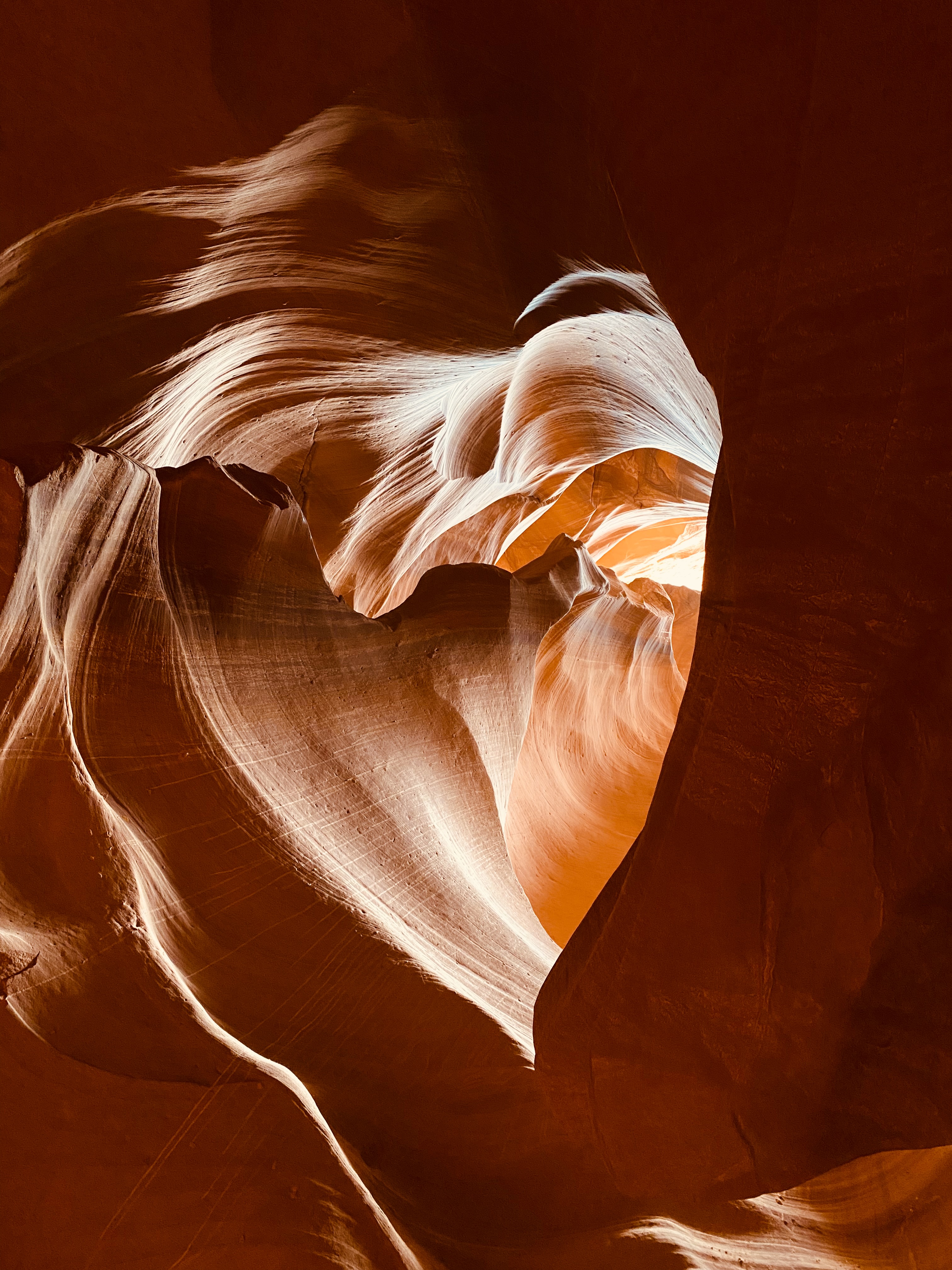
 We drove over to the Adventurous Antelope Canyon Tour base. There, we (along with 4 others) met out guide Nate and loaded up in a 1990 Excursion for the drive to the mouth of the upper canyon. We had to drive a couple of miles in deep sand in the Antelope Wash to get to the bottom of the canyon. This time slot was the prime time with the best light, so there were a lot of people in the canyon. Once again, we shot hundreds of pictures as we worked our way through with Nate. He stopped and took specific pictures for us on our phones of rock formation and of the two of us. The tour was a blast but way too short. It was nice to have a smaller tour group, but there were a lot of tours in the canyon at the same time so it was difficult to get pictures without strangers in them. When we came out the top of the canyon, we had to hike up and. To the top of the canyon wall and around back to the truck. Many of the formations had names but were too numerous to remember them all.  We can recall, The Blue Lady, the Nemo Smiling Shark, Abraham Lincoln, Flying Eagle, Monument Valley, The Swirl and The Heart!

Entrance to Upper Antelope Canyon

Lady of the blue


Heart of the Canyon

Sands of time


Exit from Upper Antelope Canyon


3 May 2023 Glen Canyon

 We drove into Page for lunch at the Grand Canyon Brewery before heading over to the Carl Hayden Visitor Center which is the visitor center for Glen Canyon Dam, Glen Canyon National Recreation Area and Rainbow Bridge National Monument. We stopped short of the bridge and walked out on the bridge to get pictures of Glen Canyon Dam and the deep canyons of the Colorado River. After crossing over the bridge, we pulled into the visitor center to find out we had picked the only day of the week that the visitor center was closed! Disappointed, we decided to continue heading up US89 toward Kanab. There were two other visitor centers along the way and both of them were closed as well. We had hope


Glen Canyon Dam

d to pick up some information on Vermillion Cliffs National Monument, a BLM run NM that US89 borders, and the Rock House Valley primitive road that goes south from US89 along the western boarder of the NM. Rock House Valley road leads to trail heads for a couple of hikes we were considering (Buckskin Gulch (Longest slot canyon in the US) and Wire Pass). The road has a reputation for being a problem and we wanted to check on road conditions. We ran into a volunteer that was just leaving the contact station who told us the road was in good shape and that we would have no problem with the Behemoth negotiating it. Along the way, we passed Cottonwood Canyon Road which perked our interest. Further research showed it is a scenic dirt road that runs 47 miles to Kodachrome State Park. So, we will add that to our list of things to do. On the way back, we went down into the Wahweep Marina area and watched them put two huge houseboats into the lake. One of the overlooks had some really nice views of the canyons that form Lake Powell.


Tuesday, May 2, 2023

30 April 2023 More Photos of Lower Antelope Canyon


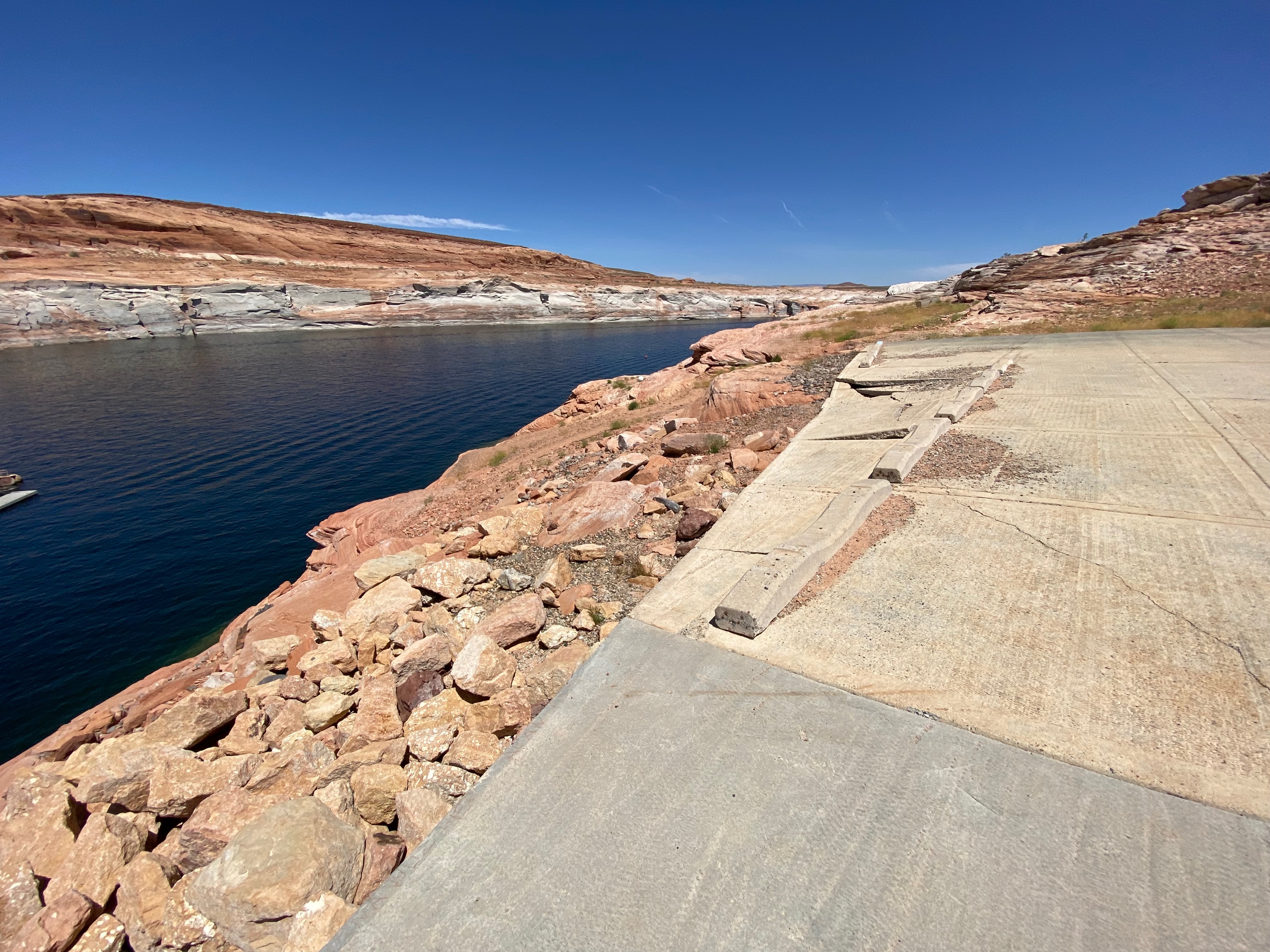
Boat Launch ramp at Lake Powel


30 April 2023 Lower Antelope Canyon

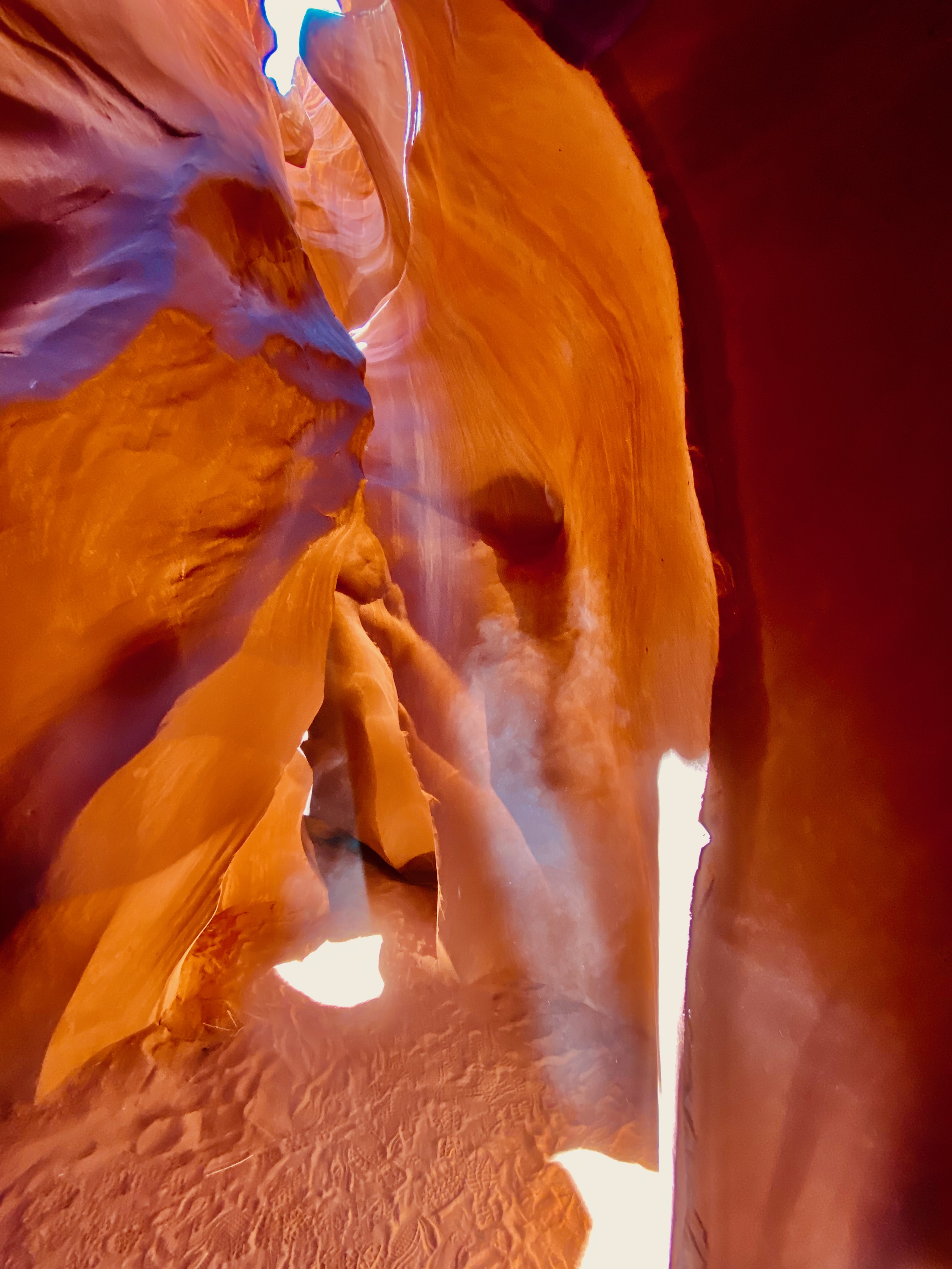
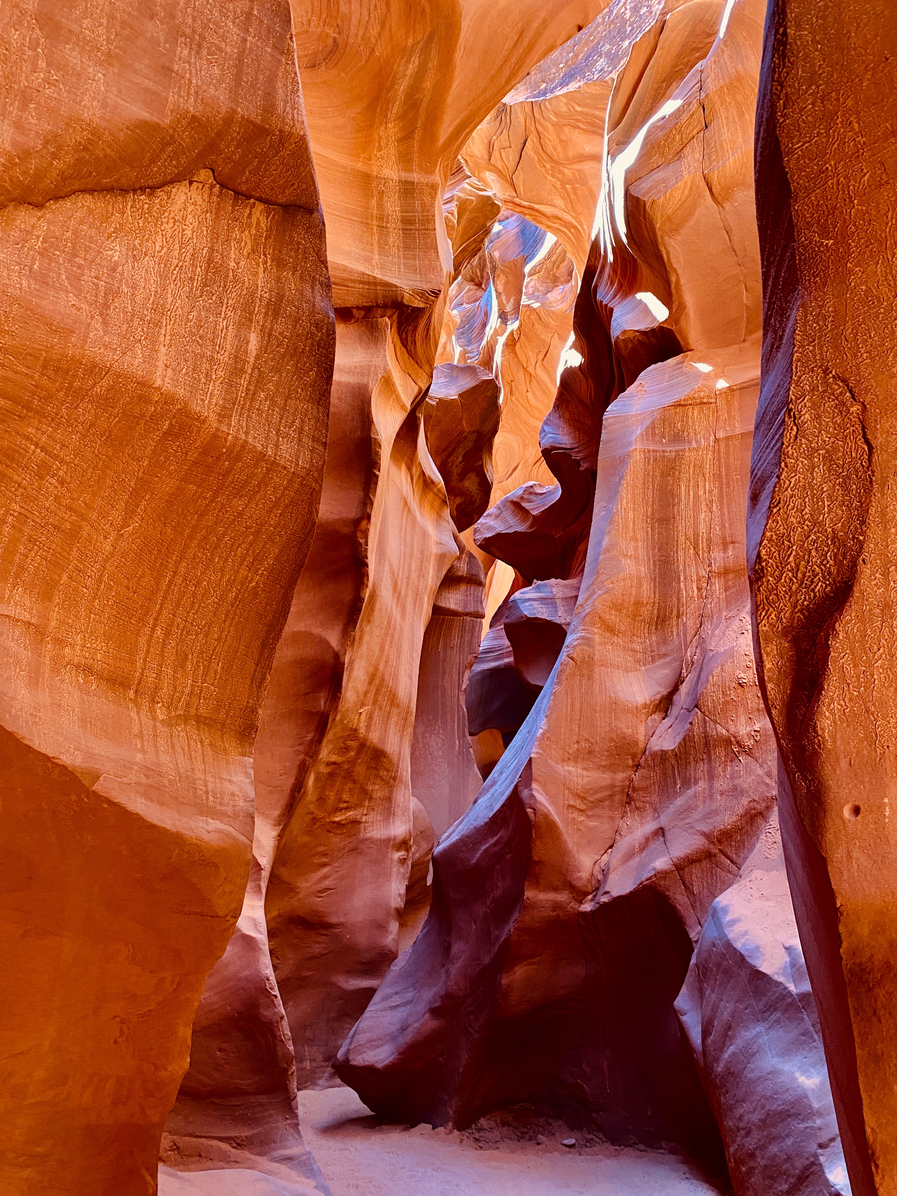
 We had an 11:15 tour time set up with Dixie’s Lower Antelope Canyon Tours ($55 per person plus fees) but were not sure what the time was where we are parked. So, after calling the tour operator, who is only 2 miles down the road, and talking with the NPS ranger, we found out that although we are in the Navajo Reservation, the RV Park is on Phoenix time and not Mountain Daylight Time. Can they make it any more confusing? We arrived for our tour an hour early and were able to get moved to an earlier tour group. That was very beneficial since the lighting in the canyon is better in the mid morning verses closer to noon. Our tour guide was Olando. He did a fabulous job keeping everyone together, helping everyone adjust their phone cameras for the best color and talking picture for the 10 people in the tour. When they used to do Photographer Tours he was one of the tour guides leading professional and amateur photographers and helping them with their camera settings. One cannot put into words how beautiful the canyon is. You could spend hours looking if they would let you. As it was, we were shuffled through at a reasonable rate considering how many people they funnel through the canyon in a day. We took hundreds of pictures! The lighting and variation in color and shadows was mesmerizing. Every direction you turned was a beautiful picture. Trying to pick just a few to put here is going to be hard. Leslie’s ankle held up pretty well. She was so captivated by the canyon, she didn’t notice it hurting too much. If it didn’t cost so much, we would go back again and again!

After the tour, we ran into Page to get lunch at Big John’s BBQ. It was delicious. On the way back, we drove down to the boat ramp to see how low Lake Powel was at this time since we hoped to go kayaking. We drove all the way to the bottom of the long steep boat ramp, and parked to look over the edge. The lake was a good 20 feet lower than the end of the boat ramp! There is a steep rocky trail around the side of the boat ramp down to a tiny beach at the waters edge if you wanted to drag you kayaks down and then back up. So much for our hopes of kayaking while we are here unless there is a massive flood of snow melt out of Colorado in the next week. The lake level also has caused the ferries to Rainbow Bridge NM to be canceled since they can’t get into the boat docks (up on dry land).