Thursday, October 7, 2021

4 October 2021 Montezuma Castle and Tuzigoot NMs

 Montezuma Castle and Tuzigoot are the last two National Park Service national monuments in the area. There is a BLM run NM close to Phoenix, called Agua Fria, but as typical of BLM, it is not developed and from what we could find from our research, just not a lot to see or do, so we decided to skip it. Montezuma Castle NM is actually composed of two units. Both units are just minutes from I-17. 

Montezuma Well is north of the main monument and is a sink hole that has water welling up from under ground. There are some cliff dwellings built into the walls of the sinkhole. Over 1 million gallons a day move through the well. There are some underground tunnels that carry the excess water out of the well to a nearby creek. Near the exit, there were inscriptions by tourists on the rock dating back to the 1890s. The water has heavy amounts of arsenic and carbon dioxide which could have proven deadly to the inhabitants. After walking the Rim Trail (1.2 miles, 102 feet of elevation gain, 595 calories burned), we headed to the main site.  After checking in at the visitor center and getting our passport stamp, we walked the only trail down to the pueblo ruins. The majority of the pueblo rooms are cliff dwellings built into the tall cliff overlooking the Verde Valley. The ruins used to be open to the public, but were closed to prevent further damage in 1951 after the interstate was built. The tallest and largest structure is four stories tall. It has been restored multiple times. The lower rooms have been left in their natural state but stabilized by the park service. It is interesting how the park service has changed its policies over the years from restoring the pueblo ruins to their previous glory to now leaving them in their natural state but stabilizes them to prevent further erosion. After visiting the ruins, we headed over to Cottonwood AZ. 


In Cottonwood, we stopped and ate lunch before going to the Tuzigoot NM. Tuzigoot Pueblo sits on a spit of land overlooking the river. At one point, it had almost a hundred rooms. There is a paved trail up to and through the ruins. After checking in at the visitor center, getting our passport stamp, and exploring the visitor center exhibits (we wondered why they were open when the visitor center exhibits were closed at the other NM), we hiked the short (0.5 mile) trail through the pueblo. By this point we are pueblo ruin exhausted after having seen them in various forms all year long. Rather than take the same route home, we headed through the former mining town of Jerome (now a major tourist attraction) and through the pass to Prescott Valley. We headed north in Prescott valley and turned off on a a National Forest road which took us into the mountains south of Williams. The road was paved most of the way and the portion that was dirt was in reasonably good shape. More storms were coming in from the west, so we hurried to get through the dirt portion of the road before the storms caught up with us. It was a pretty drive and well worth the effort. We saw some deer along side the road and were surprised how many campers were in the NF in the middle of the week. The road drops down into the historic section of Williams. 


Entrance Sign

Cliff Dwellings next to the well

Montezuma Well

Entrance Sign

Montezuma Castle

How would you like to climb that to get home each day?

Entrance Sign

Leslie at Tuzigoot Pueblo

Tuzigoot Pueblo

Tuzigoot Pueblo


3 October 2021 Williams AZ Route 66 Historic District

 We had driven through the historic Route 66 portion of Williams a couple of times and decided we needed to come back on foot. The western end of the historic district is only 3 blocks from our RV site and it was a beautiful day. Our first stop was at Roberto’s for our Mexican food Sunday fix. Then we walked east to the far end of the historic district and then back, stopping in most of the unique and quirky shops to do some Christmas shopping. It was a nice change of pace from the drives to the NMs. 

Williams historic district

Bigfoot is everywhere!

They loved the car so much they were buried in it!

WWII Whilly's jeep

No bones about driving this truck

Classic Route 66

Anyone for a hand of poker

Oldest shop in Williams

Elvis in place of Zoltar?

They really do have a huge Route 66 sign!


2 October 2021 Walnut Creek NM

 The third national monument in the Flagstaff area is Walnut Canyon NM to the southeast. Walnut canyon has hundreds of ancient sites in the walls of the canyon and on the rim. Only 25 of the hundreds of cliff dwellings are accessible by the public. We checked in at the visitor center, got our passport stamp and visited the store. We hiked the only two trails in the park, the Rim trail (0.7 miles, 39 feet of elevation gain, 293 calories burned) and the Island Trail (0.9 miles, 312 feet of elevation gain, 688 calories burned). The Island Trail has 736 stairs down and back to the peninsula that pokes out into the canyon. Along both sides of the peninsula are the 25 cliff dwellings open to the public. From the Island Trail, you can see many more cliff dwellings in the opposite sides of the canyon. The trails are all paved and in great shape. The cliff dwellings were right along the trail, and showed signs of abuse by people in the past. The hardiness of the people that had to climb down to the bottom of the canyon and haul water back up to their homes or even all the way up to the rim to water crops is incredible. They even stored extra water in cool rooms to get them through the dry periods of the year. Amazing. 

Walnut Canyon Entrance Sign

Walnut Canyon and the Island from the back of the visitor center

Cliff Dwelling on the other side of the canyon

Low Ceiling

More Cliff Dwellings

More Cliff Dwellings

Passing through where dwellings used to be.


Leslie on the trail

There are over a dozen Cliff Dwellings in this cliff

David on the trail


1 October 2021 Wupatki and Sunset Crater Volcano NMs

 We decided to go for a twofer today. Wupatki and Sunset Crater National Monuments are both located on the northeast side of Flagstaff and are connected by a scenic drive. They are pretty small NMs. We entered the north end of Wupatki NM and worked our way through the NM toward the visitor center on the south side. We stopped at each of the pueblo ruins along the way (Box Canyon, Lomaki, Nalakihu, Citadel, and Wupatki).  There were short trails (0.2 to 0.8 miles) to each of the pueblos from the parking areas. There are over 800 pueblo sites within the NM, most are ruins down to the ground. The Citadel Pueblo is built on top of a high circular cinder hill and had over two dozen rooms. All the ruins date back to 1100 AD and were occupied shortly after Sunset Crater Volcano had completed its eruption. Wupatki Pueblo, located behind the visitor center, contained over 100 rooms, a ball field and several ceremonial sites. The buildings incorporate the rock outcrops that were on the hill. After visiting the pueblos, we went into the visitor center and collected our passport stamp. The exhibits in the visitor center were still closed due to Covid. 

We then followed the scenic drive over higher altitude portions of the Painted Desert. We enter Sunset Crater Volcano NM from the north. They no longer allow people to hike to the top of the volcano so we did a short hike on the Lava trail. Having been to many volcano parks in the last three years, we were not very impressed with the lava field. Sunset Crater Volcano last erupted around 1000AD and was a significant influence on the population of the area. The crater gets its name from the yellow sulfuric material that rings the edge of the crater. After our hike, we went to the visitor center and collected our passport stamp. The exhibits in the visitor center were still closed due to Covid. 

After we finished up in Sunset Crater NM, we headed for Flagstaff to refuel both the truck and ourselves. Fuel in Flagstaff was $1 cheaper than in Williams. After filling up, we went in search of a Brewery. The first one we tried was not open to the public despite what the internet said. The second one, Lumberyard Brewery was in the historic section of town. After driving around for a bit to find a parking spot, we waked into the brewery and sat at the bar (30 minute wait for a dining room table). The food and beer were pretty good and seeing a portion of old town has us wanting to visit again.  


Entrance Sign

Box Canyon Pueblo

Lomaki Pueblo

 Citadel Pueblo

Wupatki Pueblo

Main building

They incorporated rock outcrops into the building design

Ball field

Entrance Sign

Sunset Crater Volcano

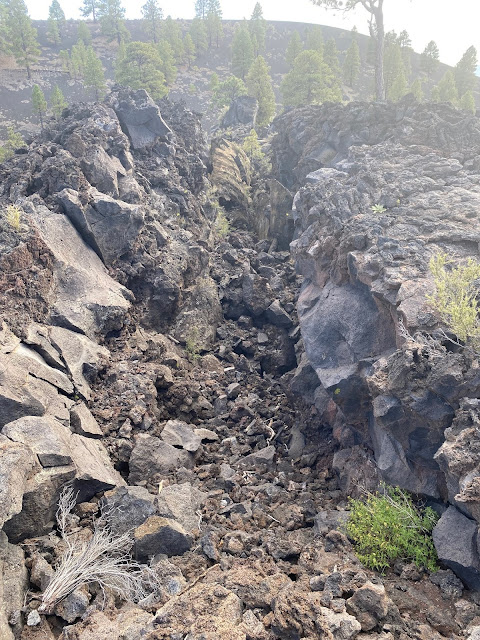
Collapsed Lava tube


29 September 2021 Grand Canyon NP

 We choose staying in Williams due to its proximity to Grand Canyon NP and five national monuments. We headed up to the South Rim of the Grand Canyon in the late morning. We expect it to take several trips to see all of the parts of the south rim we want to see. The weather forecast was for showers today and as we headed north, we could see the clouds building to the west. Our first stop was Mather Point for our first look into the canyon. This was Leslie’s first time to see the Grand Canyon and she was amazed. We walked along the rim trail taking in the incredible views and taking way to many pictures. We then strolled to the visitor center to collect our passport stamp and buys our post cards and hat. Surprisingly, they did not have any of the official National Park Coffee Cups for the Grand Canyon. As we headed back to the Behemoth, we could see the rain showers to the west. So we headed east along the South Rim Dr. We stopped at each of the overlooks and left each as the rain began at that spot. This way we stayed ahead of the heavy rain until we pulled into the parking lot for the Desert View Overlook. There the rain and hail caught up with us and we waited it out in the Behemoth for 30 minutes. But the rain showers gave us a completely different view of the canyon with heavy rain falling in and around the canyon providing dramatic views and pictures. After the rain had passed, we headed back west to the main village area. There we walked some more along the rim trail before stopping in the El Tovar Lodge and had a beer on the patio looking over the canyon. Surprisingly we found the official park coffee mug in the store in the El Tovar and added it to our collection. We tore ourselves away to head back to the Wanderer and our waiting Etta. On the way out of the park we saw a lot of Elk. The rutting season does not appear to have started yet, but it can’t be far away. 

Entrance Sign

Looking east from Mather Point

Looking West from Mather Point

Please! Pretty Please!!

The storms are moving in

Duck Rock Point


Column of Rain

Smokey

The rain is catching up to us!

After the storms from the lodge

Elk


27 September 2021 Asta La Vista Las Vegas

 David wrapped up his work in Las Vegas last week. We needed a few days to get ourselves, the Wanderer and the Behemoth ready to hit the road again. We gratefully pulled out of Las Vegas this morning and headed for the higher altitudes (and cooler temperatures) of Williams AZ. We are staying at the Grand Canyon Railway RV Park ($55 per night weekly rate). It is a really nice RV Park with the roads and sites all paved. We have a back in site but when we pulled up, the pull through directly across from our site was empty, so we pulled into it and had an easy back into our site. All the utilities are good and actually a decent WiFi system. But the park is right next to the main railroad tracks and there is a crossing nearby. So our first night we were awakened by the train whistle at 12:30, 3:30 and 6:15! But the temperatures are incredible with highs in the mid 60’s today. A far cry from the 100s in Las Vegas! After we got settled in, we broke out the Gruet to celebrate being the heck out of Las Vegas!


Good bye Las Vegas!!

Celebrating leaving Las Vegas