Today we drove the two hours to St. Ignace. The drive was pretty easy and the roads were good. Part of the drive was along the northern most portion of Lake Michigan shoreline (our second great lake). We stayed at the Lake Shore RV Park ($42 per night, no discount), which had a nice view of Lake Michigan. The water pressure was good, WiFi was strong but slow, site was a pull through that was gravel/grass and fairly flat. Folks at the front desk were very friendly and helpful.
Thursday, September 13, 2018

Saturday, September 8, 2018
8 Sept. 2018 Pictured Rocks National Lakeshore, Chapel Rock area
We drove over to the Chapel Rock area of the Park. There are several good trails here with longer distances than the other areas of the park. We hiked the three mile trail to the Chapel Falls, reportedly the prettiest falls in the park. The falls go over several tiers, the highest being about 40 feet. But access is limited by the high canyon walls making it difficult to see them well. On the way back we stopped off at Trapped Bear bar and grill. We have seen signs for something called “Pasties” for days. We initially thought maybe they just did not know how to spell “pastries”, but we saw this same spelling in multiple areas. So we stopped off to sample a “Pastie”. Turns out a “Pastie” is a meat pie. Basically shredded beef, cubed potatoes, carrots, rutabaga, and onions (no gravy) wrapped in pastry dough crust and baked. These were eaten by the miners that came over from Czechoslovakia to mine the iron ore in the 1800s. It has become a regional specialty.
 |
| Chapel Falls |
 |
| Trails in Pictured Rocks |
 |
| Yooper Snow Gauge |
7 Sept. 2018 Marquette, MI
We drove the coastline back to Marquette and explored this small harbor town. The downtown area is only a couple of blocks but some of the buildings date back to the mid 1800s. A massive ore loading dock dominates the harbor. The dock, built in 1939, replace smaller versions that had been in use since the 1850s to load Iron Ore onto cargo ships. It was shut down in 1971. In 1999 they tore down the railroad trestles that used to bring ore trains onto the top of the dock. The harbor has since been revitalized and is a pretty public area now. They were setting up for a beer fest on Saturday, but it only runs for 6 hours because apparently that is about how long it takes to overwhelm the small city jail with drunks. We ate lunch in a small brewery overlooking the harbor in a building that had been there since at least 1851. We learned the meaning of “Yooper” in one of the small shops. It means “Upper Peninsula”, as in a resident of Michigan’s upper peninsula.
 |
| Ore Dock |
6 Sept. 2018 Pictured Rocks National Lakeshore, Miners Area
Tonight is our cruise of the Pictured Rock Lakeshore. So this after noon we drove over to the Miners area of the park. Like much of the coast of Lake Superior, the Munising area was a big mining area for Iron Ore. Much of the old growth forest was cut down by the early 1900s to be used to support the iron ore mining and shipping operations. Geologically, the area is similar to Voyagers NP with a thin layer of soil over rock that has been ground down by the ice age glaciers. Here there is a layer of hard sedimentary rock over a very thick layer of soft sandstone. The beautiful cliffs of Pictured Rocks lakeshore are where the wind, ice and water has carved out the soft sandstone layer undermining the harder top surface layer. In the Miners area of the park it’s easy to see the layers. We first hiked down to Miners Falls (1.2 miles round trip). There was still a heavy flow of water from the recent rains, so the falls were really pretty. We then went to the Miners Castle Over look and finally down to Miners Beach. On the beach David found rocks from both the US side of the lake (Sedimentary, Sandstone) but also from the Canadian side (Quartz, Granite and Agate). The rocks from the Canadian side are from glacial action.
 |
| Miners Falls |
 |
| Miners Rock from the overlook |
In the evening (06:45), we boarded our Pictured Rocks Cruise Boat, the catamaran Pictured Rocks Express, for a sunset tour of the coastline. The sunset cruise, although a bit more expensive ($45 per person), provided the best lighting conditions for observing the colors of the rocks. The Sandstone formations leak water which contains minerals (Manganese, iron, calcite, diorite) which stains the rocks beautiful colors. To say they are picturesque is a major understatement. We shot over 300 photos between the two of us in two hours. The boat went past all the major rock formations and many waterfalls. With all the rain lately, the major waterfalls were flowing better than they had all summer. Everyone should add this cruise to their bucket list of things to do!! After the cruise we stopped off at Foggy’s for a beer and a late night snack.
 |
| Eastern Light House |
 |
| Bridal Veil Falls |
 |
| Miners Castle from the lake |
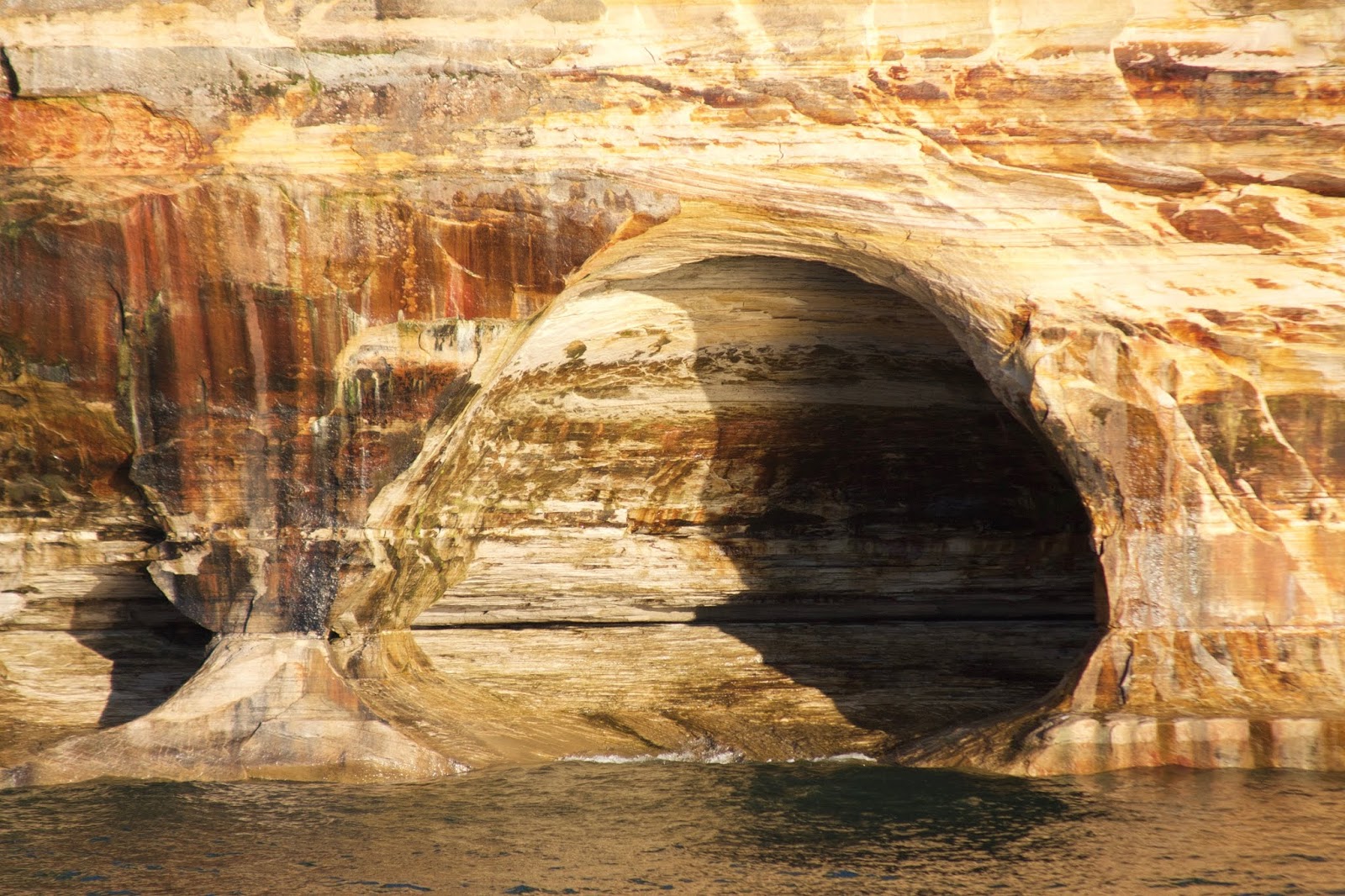 |
| Rainbow Cave |
 |
| Lovers Leap |
 |
| Indian Rock |
 |
| Sunset over Grand Island |
 |
| Grand Portal |
 |
| Spray Falls |
 |
| Chapel Rock |
 |
| Grand Portal |
Wednesday, September 5, 2018
5 Sept. 2018 Munising, MI
Last night and this morning it rained very hard for hours. Our weather apps woke us multiple alarms about flash floods and flood warnings. Between that and the pounding on the roof of the Wanderer by the heavy rain, it was difficult to sleep. The rains continued until almost noon. Whoever graded the RV Park did a very good job and there was very little pooling of water in the park. The small nearby town of Munising suffered flooding. After the rain moved out, we went out in search of the many nearby waterfalls and beaches. As expected the waterfalls were flowing fast and heavy due to the rain. We stopped in the Pictured Rocks Visitor Center and collected our 15thPark Stamp. During our hikes to the waterfalls we noticed that the maples are starting to change color to beautiful reds and oranges. Tonight the temperatures are dropping into the 40s. Perfect fall weather!
 |
| Algers Falls |
 |
| Wagner Falls |

 |
| Munising Falls |
Tuesday, September 4, 2018
4 Sept. 2018 Woodruff, WI to Christmas, MI
We pulled out of Indian Shores in the rain. Getting out of the site required some tricky maneuvering but we made it without hitting any of the trees. The drive to Christmas, MI was on two lane roads most of the way and we passed through many small towns. Michigan is the 8th state since we left Texas. The last 40 miles we were running along Lake Superior with beautiful views. The GPS took us right past the RV park, so we had to turn around and drive back about 10 miles. The RV park is brand new, just opened this season, but was not marked very well. It was a good thing we called and got instructions for the way back or we would have missed it again. The park in Pictured Rocks RV Park ($35 a week night, $40 a weekend night), right off M28. The roads are gravel, but clean, as are the RV sites, but it is level and plenty wide and deep. Water pressure is great, WiFi good and strong, but no local TV stations could be picked up and there is no cable. The rain is moving in tonight again. But the next 4 days look like they will be beautiful. We have a cruise set for Thursday night to see the picturesque lakeshore.
31 August – 3 Sept. 2018 Woodruff, WI
David had to work some over the holiday weekend. Otherwise we relaxed and enjoyed not being on the move, preparing to move or having to go and see something. We slept late, enjoyed our slow mornings and relaxed. We did some maintenance work on the Wanderer, explored the local area and avoided the crowds. When we came into the RV Park it was pretty full and completely filled up over the Labor Day weekend. Many of the spots appeared to be seasonally leases and others it appeared the lot was owned, with a lot of “improvements” even though it was still a Park Model trailer as the basis for the “cabin”. By Monday night the place was empty, including all the seasonal leases.
Subscribe to:
Posts (Atom)