Saturday, September 21, 2019

19-20 September 2019 North Coast

Well our planning for this leg of our trip could have been better. We figured out the roads from Red Bluff to the coast are very twisty and windy which significantly increased the time it would take to drive down to the coast compared to what the map looked like. It also solidified our decision to not take the Wanderer to the coast. Facing a 4-5 hour drive one way to the coast, we decided to make it an overnight trip. So we broke out our camping gear and Leslie made reservations for a camping site in Jedediah Smith Redwoods Stat Park. It took over six hours to drive to the park. We took CA36 from Red Bluff to US101 and then drove up the coast on US101. From the map, it looks like you are driving along the coast for a long ways, but in reality we only got to see the ocean once in a while. We had not left the Wanderer until almost 1PM due to David working in the morning, so it was almost dark when we arrived in the park. The campground is nestled in amongst old growth red wood trees that towered hundreds of feet above us. We pulled out David’s old Northface VE-25 tent and tried to remember how to set it up. It had been over 15 years since David had used it last. But it was still in great shape and after a few tries, we got it set up and our air mattresses stuffed in. We then back tracked to Crescent City and found a seafood restaurant to have dinner. As we were walking into the restaurant, we could here the harbor seals barking at each other. Returning to our campsite, we pulled out our sleeping bags, zippered them together (so we could cuddle!), set up a bed for Etta at our feet and climbed in our tent for a good nights sleep. This is the first time we have camped in a tent since our backpacking trip in the Chisos ten years ago for my 50thbirthday. It definitely reminded us of why we like RVing! 

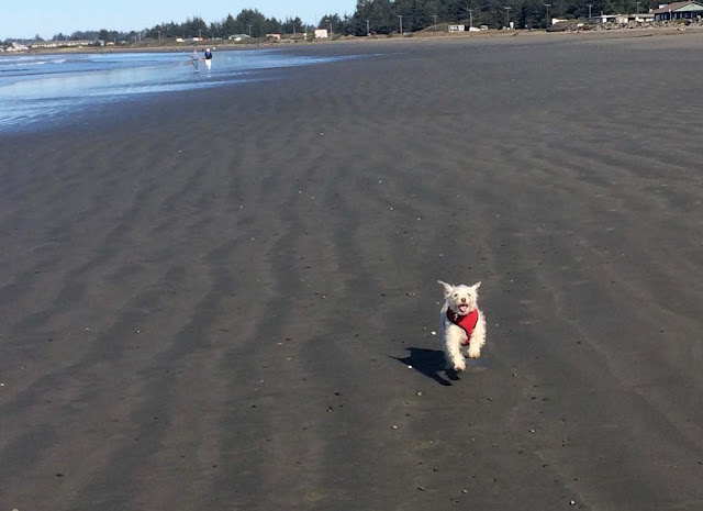
The next morning, we packed up and headed south toward the Redwoods National and State Parks. Just south of Crescent City is a large open beach, se we stopped to take a stroll on the Pacific Ocean beach. We let Etta off the leash and she took off running, doing spins and rushing back to us. She was having a blast running in the sand and into the low water. We have not seen her this happy in several months and were ecstatic that we stopped and gave her this opportunity!

Redwoods National and State Parks is a unique, in that it is co-managed with multiple California State Parks, which are so intertwined that it is hard to figure out which is which. The state parks were first set up by California in the early 1920s to try and preserve some of the remaining old growth Redwood groves. The National park was established in 1968 and expanded in 1978. But most of the lands in the national park had already been logged in the late 1800s and early 1900s, some areas were logged just prior to the national park being established. In the old growth area, some of the trees are over 1000 years old. The Redwoods can grow to over 370 feet tall and live up to 2000 years. They grow 5-6 feet per year when they are seedlings and slow down as they get older. Their bark can be 6-12 inches thick, which protects them from fire, and have an additional layer between the bark and heartwood, which has anti-insect and anti-fungal properties. The Giant Sequoias don’t grow as tall but can live to 3000 years old. We stopped at the Prairie Creek Visitor center to collect our 52nd Passport Stamp,looked through the gift store, exhibits and talked with the Park Ranger about hiking options. The building occupied by the visitor center was built by the CCC and did not have an auditorium. We decided to hike the Cal-Barrel road trail because we could take Etta with us. We took the trail about a mile out before heading back to the truck. After a while, one giant tree starts to look like another. We then drove on to the Kuchel Visitor Center on the coast and watched the park movie. We talked with the rangers there about the Bald Hills Road which runs up along the northern border of the national park and continues on into the Yurok Indian reservation where it eventually runs into CA199. The Rangers on duty did not have any information about the road beyond the park boundary beyond “there are no services”. Which just piqued our interest! So we decided to take it to CA199, which would lead us back to Redding. This section of the park was logged in the 1920s to 1970s, so it is all relatively young second growth. Not a lot to look at other than where the park service has replanted the forest and tried to fix the scars of logging. Near the park boundary, the pavement ended and for the next couple of miles the road was compacted gravel and dirt. But then to our surprise, the pavement started again and the road was actually better than it had been in the park! This area of the reservation reminded us a lot of Texas Hill Country with rolling hills, beautiful meadows and windy roads. We eventually came ot CA199 and took that to Redding. This road was much better than CA36 and if we ever want to take Wanderer, this would be the road to use. Although still windy, the turns are larger and made for faster speeds and the road was much better maintained. Once we got into Redding, we decided to find a brewery to have dinner at which would allow us to have Etta. We found the Final Draft Brewery in downtown Redding and sat on the patio for dinner and a couple beers. We arrived back at the Wanderer around 8Pm and quickly unpacked. We were really looking forward to sleeping on a mattress tonight!
Leslie and Etta in front of a giant Redwood

Coastline in the National Park

Etta playing on the beach

Entrance Sign

200 foot plus Redwood

18 September 2019 Lassen Volcanic National Park

We got up early for our hour drive to Lassen Volcanic NP. This is a small NP but packed with plenty of interesting stuff. We stopped at the Visitor center to collect our 51st Passport Stamp,watched the park movie, and looked through the gift store and exhibits.  The park contains all four types of volcanoes (Shield, Cinder Cone, Plug and Composite) in one area, which is rare. Lassen Volcano is a plug volcano, its last major eruption was on 22 May 1915. The devastation from that eruption, and the one three days prior, blew out the north east side of the mountain and caused a avalanche of melted snow, rock, mud and trees down the side of the mountain. We visited the geothermal features at Sulfur Works and then hiked the Bumpass Hell trail (which had just reopened after major repairs) (2.8 miles, 436 ft elevation gain, 657 calories burned) to the more remote formations. After seeing the geothermal formations at Yellowstone earlier in the year, we found these to be underwhelming. But still interesting. We wrapped up our visit by driving the rest of the main road with a short hike through the area devastated by the eruption in 1915. It’s amazing how the huge boulders were rolled down the mountain by the force of water and mud. 
Entrance Sign

Mud Pot 
Bumpass Hell geothermal formation

Mount Lassen


16 September 2019 Phoenix OR to Red Bluff CA

It rained all night, but in the morning, the sun broke out for us to get packed up and on the road. The RV park did come out yesterday and trim the limbs we requested (took two calls to the office) so we could pull through our site. There are several good size climbs on I-5 on the way south to Red Bluff, but we did not have any issues. We had beautiful views of Mount Shasta most of the way. That is one big mountain! We are staying at the Durango RV Resort ($50 per night with GSC). It is a beautiful RV park with wide streets, beautiful landscaping, long wide sites, everything a good RV park should be. We would definitely stay here again. We plan to visit Lassen Volcanic National Park and Red Woods National Park over the next several days. 
Mount Shasta


Durango RV Park, Red Bluff, CA


Tuesday, September 17, 2019

15 September 2019 California Twofer

Leslie woke up feeling better this morning. We headed out for northeastern California to two national monuments. On the way, we drove through Cascade-Siskiyou National Monument on Oregon State road 66, which is a BLM run monument. We did not stop at the visitor center, so are not claiming this monument in our destinations. We dropped down into California on 139 to Tule Lake, California. We got our first glimpses of snow-covered Mount Shasta in the distance. California is our 21st state. 

Tule Lake was the location of another of the War Relocation Centers for Japanese citizens and Japanese Americans. Part of the WWII Valor in the Pacific National Monument, Tule Lake houses the temporary Visitor Center in the Fair Ground Museum. Unfortunately, the visitor center is only open from Memorial Day to Labor Day. So it was closed, but we peeked in the widows and stopped at the site of the former Segregation Center. Most of the buildings are gone from the relocation/segregation center, sold to local farmers after the war, and only a few survive in the former POW camp.

Japanese citizens were prevented from becoming American Citizens for 17 years prior to the outbreak of WWII, but their children, born in the USA, were US Citizens. The Tule Lake Relocation Center was opened in 1942. Built very similar to the other relocation camps (IE shoddy), it was originally built to house 12,000 “Internees” (note they did not meet the legal definition), it was expanded and eventually held almost 19,000. In 1943, the US Government issued a questionnaire to the approximately 120,000 Japanese, German, and Italian “internees” in an attempt to determine their “loyalty”. Japanese citizens, and Japanese American “internees” that were determined to be disloyal, based on their answers to the questionnaire, were all sent to Tule Lake from the other 9 Relocation Centers, since Tule Lake had the highest number of “disloyal” internees. Tule Lake was renamed the Tule Lake Segregation Center and was taken over by the Army. More guard towers were built and the produce fields were enclosed with more guard towers and barbwire. When the Tule Lake “internees” refused to bring in the crops, the command brought in several hundred “internees” from other camps to bring in the crops. These “internees” were housed in a former CCC camp near Tule Lake. In 1944, local farmers needed additional help to bring in the crops of Potatoes and Onions. So the former CCC camp was converted into a POW camp by 135 Italian POWs and eventually house 800 German POWs who worked in the local farm fields. Many of the POWs attempted to stay in the area after the war but were not lucky enough to draw one of the lottery numbers for some of the local land.

We continued on to the southern entrance to Lava Beds National Monument. We stopped at the Visitor center to collect our 49thand 50th(We were able to get a Tule Lake stamp as well) Passport Stamps,watched the park movie, and looked through the gift store and exhibits.  Lava Beds National Monument sits on top of the Medicine Lake shield volcano. The largest volcano in the cascades range. The area is composed of multiple layers of lava flows. There are over 500 lava tubes in the park. We worked our way through three of the Lava Tubes that are open to the public. The first was Mushpot Cave, which is the only lighted cave in the park.  Leslie wasn’t too impressed until David told her that she was wearing her sunglasses.  We had to duck and duck walk through sections, but it was a good example of a lava cave. We then drove the cave loop and hiked from the lower Sentinel cave entrance to the upper Sentinel cave entrance using just our flashlights.  Leslie must add that a pencil light flash light is not a life-saving device!!!!    Do not look back because it is totally black.  You can only hope someone closed the closet door and the monsters have no access.  The trail guide said there was a “smooth” trail through these caves, but their definition of smooth leaves something to be desired. However, compared to the piles of jagged rocks around us, it was definitely easier. Being in a completely dark cave with only the light of our flashlights to navigate with was an experience. We then backtracked to Valentine Cave, which is different from the other lava tubs since it was formed by fast flowing lava, so the walls and ceiling are smooth and the floor was flowstone. It was a fascinating tunnel to explore, again with only our flashlights to lead the way. 


We then drove to the northern section of the park where the Modok Indians held off the US Arm in 1879 for 6 months. We explored a couple of the battle areas before heading out the northeast exit. About 5 miles outside the northeast exit is another portion of the park where Tule Lake used to wash up against a lava dome island. The lake as been drained. Around the bottom of this lava island are over 5000 petroglyphs from the Modok Indians. This is one of the highest concentrations of petroglyphs in the US. They were not as distinctive as many of the other petroglyhs we have seen over the last 8 months, but the sheer quantity was impressive. After walking the length of the cliff, we headed back to Phoenix. As we came into the Cascade-Siskiyou National Monument we ran into the storm front coming in from the west. Nothing like wet, slick, dark, twisty, windy, narrow roads to get your attention.  

WWII Valor in the Pacific National Monument Visitor Center

One of the Watch Towers from the Tule Lake Segregation Center

Entrance sign to Lava Beds NM

Entrance to Lower Sentinel Cave

Exit from Upper Sentinel Cave

Smooth sides of Valentine Cave

Petroglyphs

Friday, September 13, 2019

13 September 2019 More Caves

We headed west today to the Oregon Caves National Monument. The road up to the monument is VERY curvy and narrow. This is a fairly small national monument surrounded by national forest. It was made a national monument in 1909 by President Taft. This cave is different from the others we have been to in that this cave is in Marble. We stopped at the visitor center to collect our 48th Passport Stamp,and looked through the gift store and exhibits. They don’t have a park film to watch. We arrived around 11Am but our reservations were for the 1 o’clock tour. We heard that there might be an 11:30 tour so we talked to the ranger about changing to the earlier tour and were able to arrange it. We are really glad we did! The 11:30 tour group was only 6 people and the 1pm tour was closer to 20 people. They made both of us take off our shoes so they could ‘decontaminate” them since we had worn them in other caves (concern is about bat powder nose). The cave has had people going through it since the mid 1800s. There are inscriptions in the cave that go back to at least 1883 from the Father of Oregon geology, Professor Thomas Condon.  He had his entire class with him (half were women) and while in the cave they all signed their names on a prominent stalagmite in pencil. An attempt to erase the graffiti was made but a layer of calcite had preserved their names forever…until more calcite build-up eventually covers it over.  Preservation of history or graffiti that needs to be cleaned up? The CCC in the 1930s made big improvements to the cave accessibility and opened up new sections of the cave not previously known about. There were extensive renovations made in the 1990s as well. 

We met up with Ranger Simon and the other members of our tour group. This is a much more physical cave tour than most of the others we have been in. There were lots of low sections that required stooping, duck walking or limbo stepping. There are not a lot of cave formations compared to other caves due to type of rock and they are not as colorful as we have seen in other caves (lack of minerals in the marble). They found 38,000 year old Jaguar bones deep in the cave as well as bones of a 50,000 year old flat face bear. No human habitation was found. This cave has a fairly strong creek running through most of it. The tour lasted 1.5 hours. 

After the tour we pulled out our lunch and found a nice picnic table. The lodge was closed for renovations so we could not get a beer. While we were eating our lunch, a Ranger came up and talked to us for a while. The lodge was originally built in the 1920s and the stream that runs through the cave also runs through the restaurant. It only has 23 rooms, but apparently is booked full in most summers. The visitor center also has quarters for rangers and scientists in the upper floors. The siding of the buildings is made of cedar tree bark, which provides a unique look. We would like to come back here sometime when the lodge is open just to stay in it. 

On the way back to the Wanderer, we decided to check out a vineyard. We stopped at Deer Creek vineyard for a wine tasting. We walked a way with a couple bottles of their refreshing and light wines. 
Entrance Sign

Historical Plaque

Leslie at the Entrance to the cave

Heart of the Cave Formation

Flow Stone Formation

Visitor Center

Thursday, September 12, 2019

11 September 2019 Deep Blue Lake

The drive from Phoenix to Crater Lake National Park is roughly 1.5 hours on the 
Rogue-Umpqua Scenic Byway (Oregon 62). We stopped at the visitor center to collect our 47th Passport Stamp,shopped in the gift store (David picked up his hat), watched the park film and then we talked with the rangers about trail options. We had Etta with us since it was going to be a long day, which limited our hiking options since we did not want to leave her in the truck for too long and we could not take her on any of the trails. We then drove the 33 mile Rim Road, stopping at most of the turnouts to absorb the spectacular scenery. This is a stunningly beautiful park. The lake water is so pure and incredibly blue. The lake contains over 5 trillion gallons of some of the purest water in the world. The lake was formed when the volcano collapsed into the magna chamber below it 7,700 years ago. The local Indian tribes have tales passed down through generations about the eruption and collapse. The lake is filled with rain and snow melt (Over 44 feet of snow every year). It’s the deepest lake in North America. There are no river/creeks that flow into the lake. There are no outflow rivers/creeks. The lake maintains it level via evaporation (18 billion gallons per year) and seepage (15 billion gallons per year). After working our way around most of the Rim Road, we took the side road to the Pinnacles trailhead. There are formations off this trail that were developed by hot gas seeping up through volcanic pumas which melted and hardened the pumas so that it did not erode like the pumas around it leaving the pinnacles. We hiked the short trail (.7 miles, 62 feet of elevation gain, 148 calories). We then made our way to the deck off the Crater Lake Lodge and sat back in the rocking chairs and enjoyed an adult beverage while soaking in the stunning views. We would have loved to sit on the deck and waited for sunset, but Etta was already squirming for her dinner. So we had to head back to the Wanderer. We really need to come back here and stay in the lodge to see the lake at sunrise and sunset sometime in the future. 

Entrance Sign

Wizard Island in Crater Lake

Phantom Ship Island in Crater Lake

Us

Panoramic o Crater Lake

View from nation of Crater Lake Lodge

9 September 2019 Vancouver WA to Phoenix OR

We left Vancouver this morning in the rain. The drive down I-5 to Phoenix, Oregon took longer than expected due to the weather and traffic in Portland. It was a seven hour drive when it should have been 4.5. We are staying at the Holiday RV Park ($41 per night with Good Sam Discount) in Phoenix which is just south of Medford. The Park is right off I-5 and as we found out, under the flight path to the Medford airport. So it is a fairly noisy location. Our site has some low hanging branches which will have to be cut before we leave. But water pressure is good, we are able to get Sat and OTA TV. The WiFi is slowwwwww. We chose this location since it is centrally located to one national park and three national monuments. But we also have found there are several highly reviewed Mexican restaurants in the area, so it looks good for the Mexican food Sunday tradition. Oregon is our 20thstate. 

Sunday, September 8, 2019

8 September 2019 Let it Rain

We had planned on visiting Fort Vancouver today, but found out visitor center is closed on Sunday and Monday! So we considered heading over to the coast but after seeing the raining moving in from the west, we decided to just stay home and catch up with chores. David checked out the possibility of driving to our next destination on US101 along the coast, but between the rain forecast for tomorrow, and the presence of two low tunnels (Only 14 feet in the center, no clue what they are at the edges) along the coastal route, we decided we would just stick to the I-5 tomorrow. 

7 September 2019 Tour of the Columbia River Gorge


In the morning, we met up with David’s cousin, Justin (Jeff’s son) and his girlfriend Ashley. They had offered to give us a tour of the Columbia River Gorge. We had a quick lunch at a local grill before heading up the gorge. Justin was driving us in his brand new (less than 500 miles) truck. As we started out, it was pretty misty and cool. Normal weather for this area. As we drove up the gorge, the sun came out and the clouds were left behind. The gorge was cut through solid lava walls by the river and is shaped by several prehistoric floods that rushed through the gorge during the last Ice Age. The river is dammed up for power generation, resulting in a large lake up stream that is world renown for its wind and kite surfing.  It had rather big waves and white caps for a lake! We drove up the Washington side, stopping at various overlooks before going to their favorite vineyard. After a great wine tasting, and a few bottles purchased, we crossed over to the Oregon side of the river and followed the old US30 (There it is again!) highway back to the west. The clouds reappeared and it began to thunder and rain. We stopped at three of the waterfalls along the route. The cliff walls are high here so the waterfalls are pretty spectacular.  We exited the gorge just east of Portland and crossed back over the river to the Washington side. After a quick stop to take Etta out and feed her dinner, we headed into downtown Vancouver and had dinner at an excellent wood fired pizza place. Thank-you Ashley and Justin for a great day!  Promise that you will try and visit this beautiful area more often than you do.  Life will always get in the way.

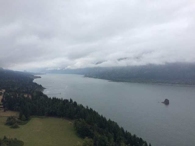
Columbia River Gorge

Multnomah Falls

Justin and Ashley in front of Latourell Falls

6 September 2019 Port Angeles to Vancouver WA

We pulled out of Port Angeles a bit later than we planned. We decided to take the US101 down the west side of the peninsula rather than going back east. The portion of the road around Lake Crescent is narrow and we had to watch for the overhanging trees within the Olympic NP. But once beyond that, the road opened up and was a less stressful drive. We stopped off at an overlook near Beach 3 in the park for lunch with a wonderful view of the Pacific Ocean. 


We arrived in Vancouver WA at 6pm. Later than we had hoped. We are staying at the 99 RV Park ($28 per night with the Escapees discount) near the junction of I-205 and I-5. It’s not a very big park, but they had an end row site that would fit our Wanderer. We step right out in the road with no “yard”. But it’s only for a three nights and this location provides easy access to the areas attractions.
Lunch stop along Beach #3

5 September 2019 Local Treats


David worked in the morning and early afternoon. Leslie went to another Walmart hairdresser and once again was disappointed with the results. The color was good but they took too much hair off when they trimmed. Never mind…it grows back. In the afternoon, we changed out the window on the living room slide with the new one sent by New Horizons. It went in pretty easily, but Leslie almost took a tumble climbing up the ladder to hold the window in place while David screwed it in from the inside. The window is held in place by compression between the outer frame and inner frame. It’s not screwed into the wall like windows in sticks and bricks. In the evening we joined David’s cousins Jeff and Deborah for dinner at their favorite restaurant in Sequim where they own a townhouse. The restaurant uses only ingredients from the local farms. It was excellent! Thank-you Jeff and Deborah for a delicious dinner!

4 September 2019 Corner of the Lower 48


We decided we needed to visit this corner of the lower 48 states since we would be visiting the opposite corner of the country in March next year. So we drove to Cape Flattery on the Makah Indian Reservation, which is the furthest northwest corner of the lower 48 states. We have been to Homer Alaska, which is the furthest west you can drive on the American Continent when we did our Alaska Cruise a few years ago. Cape Flattery is not the most western point on the Lower 48 states, that is a few miles south of Cape Flattery, nor is it the furthest point north, that is in Maine, but it is the most Northwestern point. The trail down to the point of the Cape is wet, slippery and steep in places, but the views at the end are beautiful. We even took Etta with us! It’s been a while since we’ve been able to include her on hikes.  We had to stop at the Reservation Museum to pick up a Recreation Pass to be able to drive to the Cape and hike the trail, but the nominal fee ($10) was worth the views! We then went to dinner at LDs Woodfired Grill for a dinner that was excellent. Our first good seafood since we arrived on the peninsula. 


2 September 2019 Hoh Rain Forest


Once again the weather forecast was for rain in the morning as we headed out for the west side of the park. It was a two hour drive to the Hoh Rain Forest visitor center. We checked out the exhibits and checked with the rangers on the trail conditions. We decided to hike the Hoh River Trail to the first set of waterfalls. The hike through the old growth trees, hanging moss (6.1 miles, 220 ft of elevation gain, 1507 calories burned) was humid! But it was a rain forest, so it was supposed to be! The first 2.5 miles were fairly flat but the next .5 miles was some steep up and down. We made it to the first waterfall in quick time. There was a bridge over the stream, but the really big drop was higher up in the forest and there was no trail to climb up to it. We decided to go on up to the second waterfall indicated on the All Trails map. That was only .2 miles further, but it was more of a babbling brook than a waterfall. The trees were massive and all of them were covered with moss and lichens. The ground was covered with ferns. Even here, the trees were starting to change colors. The reds and yellows contrasted with the deep greens. We came across some elk poop on the trail but did not see any critters beyond a squirrel. We have become quite the northwest hikers. We can tell elk poop, from deer poop and bear poop! We can even tell the difference between black bear poop and grizzly bear poop! Black bear poop has seeds and berries in it. Grizzly bear poop has those little bells they sell the tourists to wear to scare the bears away!

Its Mossey

Waterfall #1

David on the bridge by waterfall #1

Colors are changing already!

1 September 2019 Rialto Beach

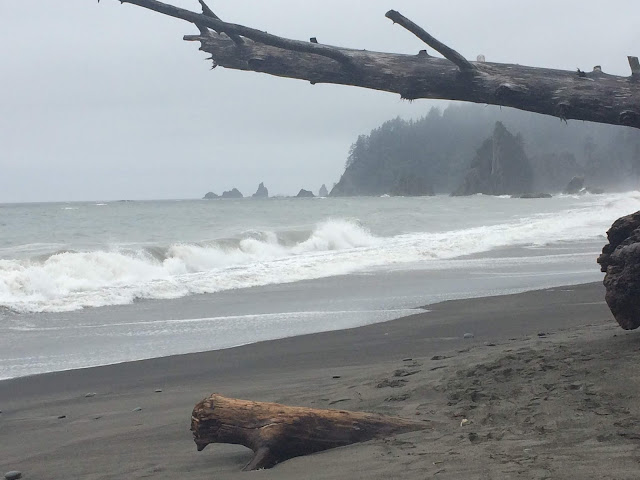
We checked the weather when we got up in the morning. The prediction for the coast was for rain in the morning but clearing in the early afternoon. So we decided to chance it. We reviewed the various beaches and decided to go to Rialto Beach. The drive over to the beach was an hour and a half. When we pulled into the parking lot it was pouring rain. After finding a parking spot big enough for the Behemoth, we sat back and watched the rain pour down for 30 minutes. People were still walking out to the beach in raincoats or under umbrellas and coming back soaked. After about a half hour the rain began to slack off and eventually stopped. We climbed out and walked down to the beach through massive tree trunks piled up on the shore to our first view of the Pacific Ocean. Stunning! We walked onto the beach and just soaked up the view. It was still misty and the clouds were hanging low. We could see islands and rocks sticking out from the sea, waves crashing on the shore, sea gulls flying overhead. We decided to walk down the beach to the north. It was captivating. Before we knew it, 2 miles had cruised by and we came to a point where the in coming tide made going any farther a wet proposition. We misjudged how fast the tide was coming in and getting back became a dodge game with the waves and the piles of tree trunks on the shore.  We were certainly surprised by a couple of waves. So we can definitely say we dipped our toes into the Pacific Ocean. We were soaked from the knees down. Rialto Beach is a very special place. Critter Sighting: We saw a Sea Otter and lots of Loons from the beach. On the way back, we spotted several deer on the road out and some elk as we got close to the RV park.